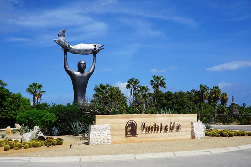
Today: Land’s End. Next stop: World’s End!
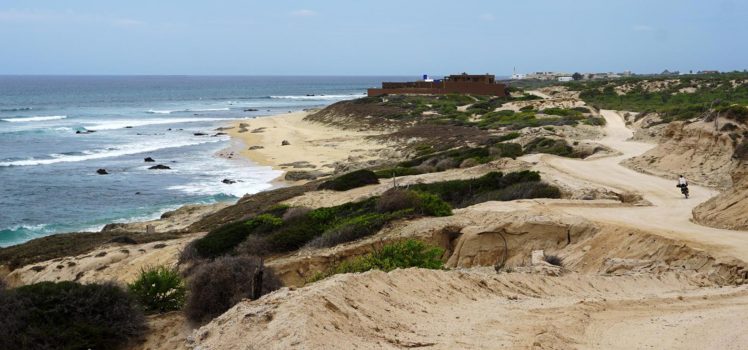
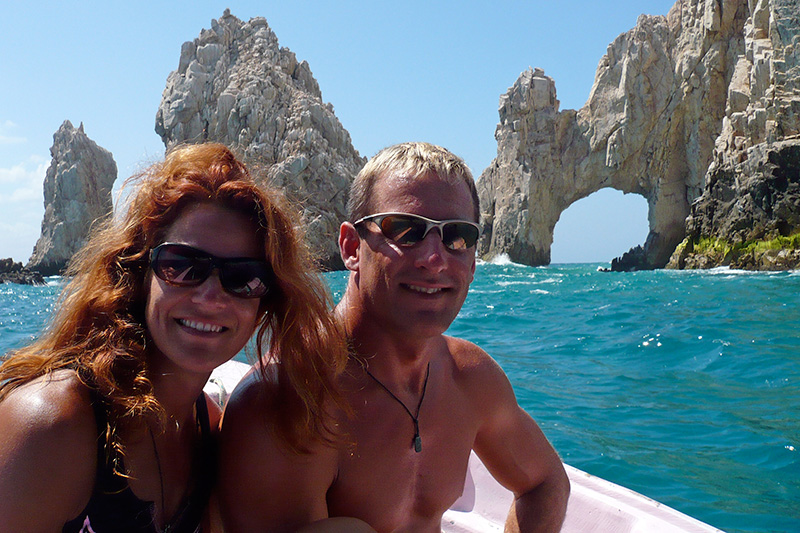
Excluding the very first few days of our trip when we made our way from Corona, CA to San Diego, and our little mechanical-inspired detour to Loreto, Rebecca and I have been consistently following the blue line on our GPS, sticking to the Baja Divide route like glue. Even though our urge to continue along the set track was quite strong, we decided to deviate from the route to follow the coastal roads down to Cabo San Lucas rather than take the path over the mountains north of here. Nicholas and Lael, the founders of the Baja Divide, apparently had very good reasons for choosing to bypass Cabo San Lucas when they plotted the course – some of which we can now attest to – but seeing how this is the only spot in Baja that we have ever visited before, 10 years ago by airplane, it seemed fitting that we make this a stop on our bike journey. We made it to Land’s End in Baja. Now we just need to make it to Ushuaia, the End of the World!
Land’s End, Cabo San Lucas, 2007.
After resting for the night at a scenic little hotel, we set off from La Ribera at first light. The owner of the hotel was kind enough to put his coffee maker on a timer so that we could caffeinate ourselves before beginning our trip. That was appreciated as making coffee is often one of the things that gets omitted from our morning routine.

The pretty courtyard of the Hacienda de Palmas hotel.

Getting the bikes ready, pre-coffee.

Our breakfast stop, in the shade of this seemingly closed hotel.
Shade has become one of my new favorite things!
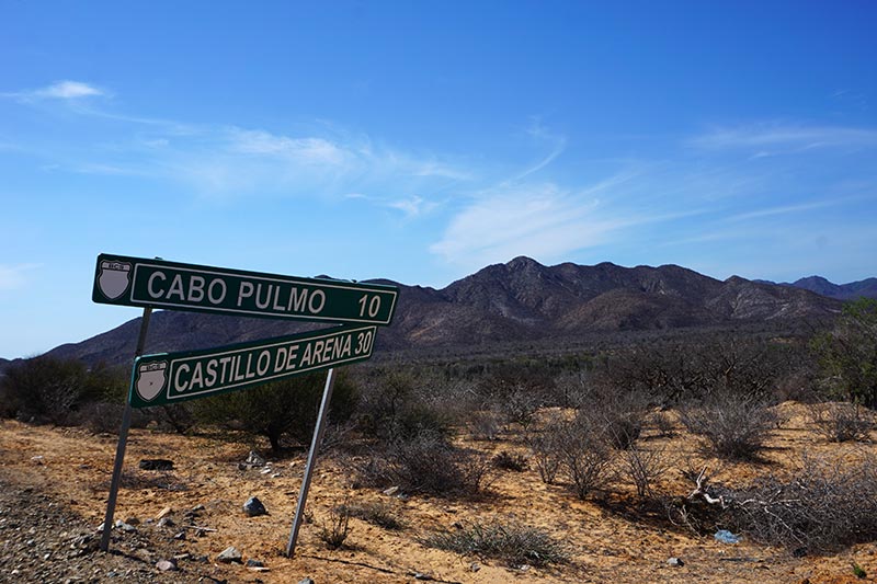
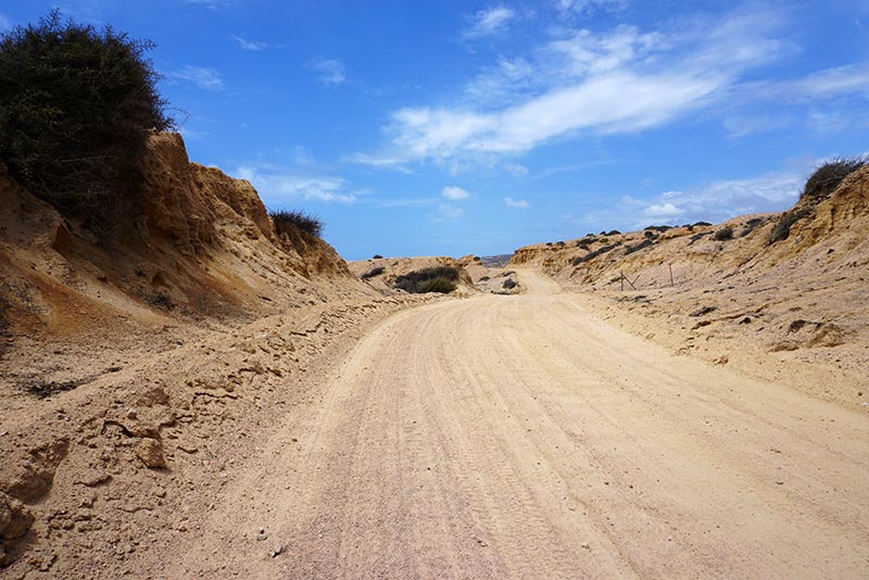
Our first stop after La Ribera was to be Cabo Pulmo, a mere 30 km from our starting point. Not only was the distance short, but the route was supposed to be flat. Easy, right? Well, yes and no. As we’ve come to expect, nothing is ever really easy, and it was sand that made it tough this time around. We rode through miles of loose sand, some so deep that if we weren’t super careful about where we went, our bikes would come to a complete standstill, forcing us to push them to a spot where the sand was less deep before we could begin riding again.

Loose sand may be the toughest thing to ride through.

Loose sand AND washboard ruts!

Someone went all out decorating this roadside shrine!
The Baja Divide, the route that we’ve been following, is the brainchild of Nicholas Carman and Lael Wilcox. Having now spent more than 10 weeks riding from San Diego to the bottom of Baja, I can’t even fathom the amount of work that they must have put into this project. The time required to simply select and plot the route, and to recon the resupply points, seems immense. As often as I have taken their names in vain when faced with extremely tough sections of the route, I am nothing but grateful for their efforts. Thank you so much, guys!

Fast-rolling flat pavement!
The mountains are never very far off!
Along with some beautiful scenery, the trip was punctuated by a couple of other unique occurrences. First, we saw our second bobcat. As with the first time, the bobcat simply ran across the road in front of us, disappearing into the bushes. The second unexpected thing we saw was a burned out vehicle on the side of the road. There were actually still flames underneath it! There was no one around when we first came upon it but as we stopped to take a couple of pics, two vehicles passed us. Both parties seemed as perplexed as us. One simply shrugged his shoulders and kept on driving. The second actually stopped his car to get out and look around. Weird.

If you look closely you can see flames by the rear wheel.

Winching her way up a hill.

Always on the lookout for opportunities to shoot from new angles.

We had some beautiful views of the coast.
In spite of sand and other diversions which slowed our pace, we still made it to Cabo Pulmo by noon. We initially went searching for a bar that a friend had told us about, only to find that it was closed for the week. Bummer! Still needing to eat, we made our way to the most obvious restaurant, located above the dive shop. Even though drinks were cold, the food was OK, and our waiter was friendly, the place left us with a bad taste in our mouths. After more than 2 months in Baja, that lunch would turn out to be the most expensive meal we have had, and it wasn’t that good! Our mistake was that we didn’t notice that the prices were listed in US dollars instead of pesos. What can I say? When you’re as dehydrated as I was, $9 looks a lot like 90 pesos. The only thing is, it’s 60% more! My bad. I should have been paying closer attention, especially after our experience during the last leg of our trip.

Signs like this lined both sides of the road.
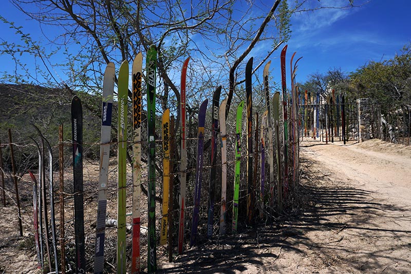
Snow skis? Rebecca picked out the brand that she used to race on.
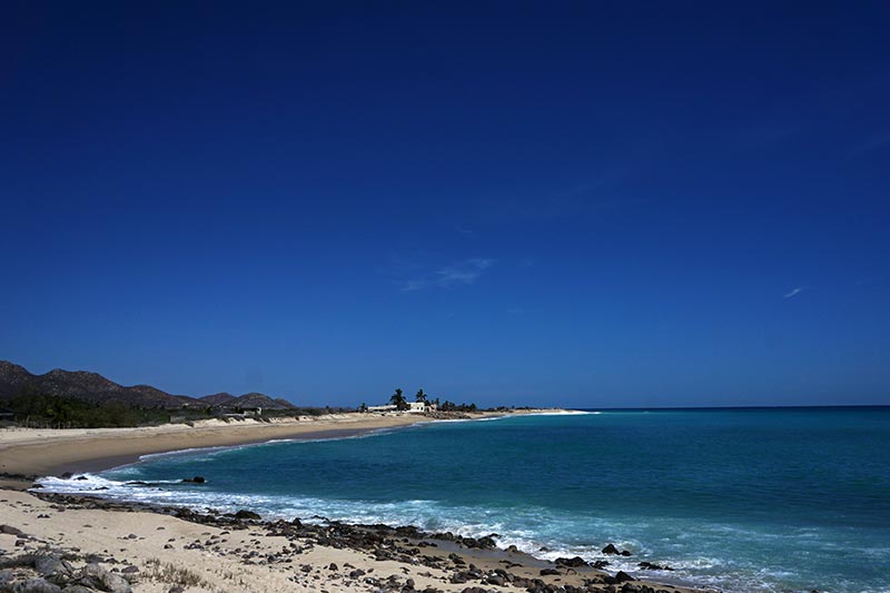
The photo doesn’t do the color blue justice.
Again, following the advice of a friend, we made our way to Alicia’s to secure a spot to sleep for the night. Eight hundred pesos got us a little cabaña and although it didn’t have AC or WiFi, it was pretty sweet. For the record, Cabo Pulmo seemed to be a big tourist destination, with diving and snorkeling at their marine park the big attraction. There were a lot of tourists present which explains the higher prices. The use of US dollars on the menu still pisses me off though!

Enjoying the water view as we rode into Cabo Pulmo.

The waves along the coast were significant!
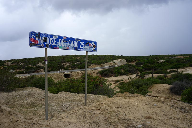
The next day we again left early, setting off on the road before many people were up and about in the town. The split to where the Baja Divide route would head out over the mountains was to occur approximately 6 miles from Cabo Pulmo. After that, we’d be on our own. While it was unlikely that we’d get lost – the coastal road was shown on our GPS – the big unknown was resupply stops. Specifically, would there be any? A waiter at one of the restaurants told us no, there would be no places to resupply all the way to San José del Cabo. This would turn out to be false, but just to be safe, we filled one of our 6L water bladders to make sure that we wouldn’t run out.

This beautiful bay was all marked as private property.

Baja Divide to the right, coastal road straight ahead.
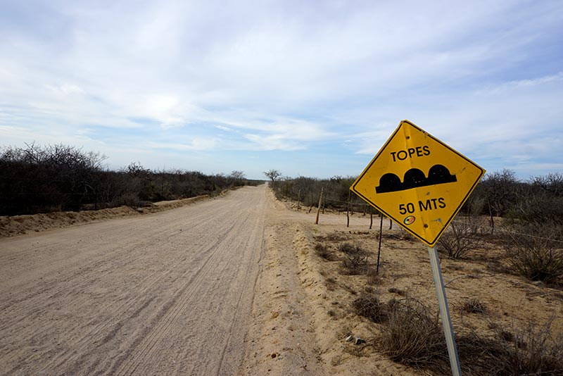
We expected the route to continue to be relatively flat most of the way to our next destination, and it was, but hand in hand with a flat gravel road comes the inevitable washboard ruts. What can I say? We just sucked it up and dealt with it. The ironic thing is that we frequently came across signs for speed bumps – sleeping policemen to the Brits – but they were indistinguishable from the 1000s of other bumps along the road. Yes, seriously!
Ha!

Not comfortable to ride on!

A fancy restaurant 16.5 miles outside of La Ribera.
As mentioned in the Baja Divide guide, one of the reasons that the road we were traveling was omitted from the route was because much of the property bordering it is fenced in, and marked with no trespassing signs. This was absolutely true. In fact, the private property signs were so numerous that I actually found them to be quite obnoxious after a while. I mean, we get it… the barbed wire fence is a good indicator that you don’t want guests!
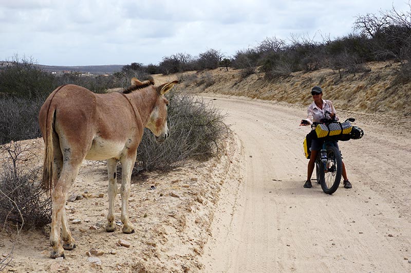
The jackass whisperer?

Trying to make new friends wherever we go.

A beautiful beach on which to camp?

Nope. Private property!
Once again while on route, we found ourselves riding with an electrical storm threatening us. The sky darkened, frequent thunder could be heard, and the odd rain drop could be felt. Rather than be caught unprepared, we tucked our iPhones away and donned our rain jackets. Just about the time we felt as if a downpour was imminent, we came across a small tienda – a store – on someone’s property. We stopped to purchase a couple of drinks and while there, asked if we could wait out the impending storm. Surprisingly, the old man didn’t say yes. He simply said that it wasn’t going to rain. Given our experiences of the past few days, I was not so confident with his prediction. As it was obvious that we weren’t really welcome to wait there though, we carried on.
Note: He was correct, the rain never amounted to much more than a few sprinkles. That said, his reaction to our request was still completely out of character from just about everything else we have experienced in Baja.
Much of the riding looked like this.
Pavement? A very small stretch.

Clouds rolling in.
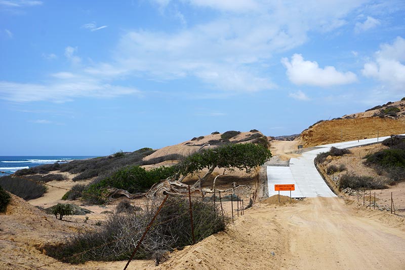
Twenty five kilometers outside of San José del Cabo we came to a junction. The dirt coastal road continued on ahead of us but a signposted paved road, apparently leading to San José, turned off to the right. Even though I had previously studied the route and knew that taking this new road would lead to more climbing, we were sucked in by the thought of some easy-riding pavement. Now that we’ve completed it, I’m still not sure which route was ultimately the best to take. The paved road definitely led us to some climbing. In fact, there were several long, 1st-gear “gatekeeper” hills just outside of town. We were able to make some good time on the flats before them though, and even briefly experienced the unicorn of cycle touring, a tail wind!

Where there were no mansions, the road frequently hugged the coast.

Rebecca enjoying a fast descent.
Entering in to San José del Cabo on a super busy street, we were a bit shell-shocked by all the cars and trucks whizzing past us. When presented with an opportunity, we took a random road off the highway and fortunately or unfortunately, depending on how you look at it, found ourselves right in the middle of a tourist district. Even though it’s nice to have such a selection of bars and restaurants to choose from, finding affordable accommodation in an area like that was tough. When we asked a waiter if he knew of an economical hotel in the area, he simply shook his head and said no, not here, there isn’t one!

I wonder if this is a legit aide to navigation.

With clouds like this and thunder, I’d say that rain is imminent!
Do we take the paved road or not?
After some degree of searching, both by pedaling around and consulting Google, we did find a spot for the night, even though it was more than we wanted to pay. We made the decision then and there to do a bit more research before setting off the next day for Cabo San Lucas, hoping to be better prepared when we arrived there.
The gatekeeper hills of San José del Cabo.
We made it!
When it came to getting from San José del Cabo to Cabo San Lucas, we opted to take the paved coastal road between the two cities. The trip was just over 30 km and we made excellent time riding it, perhaps the fastest of our trip. The price for that fast riding was the loss of several of our lives, having had them scared out of us by fast-moving vehicles. Once again, I don’t know how people consistently ride their bikes on high-traffic roads. It is way too stressful for us!
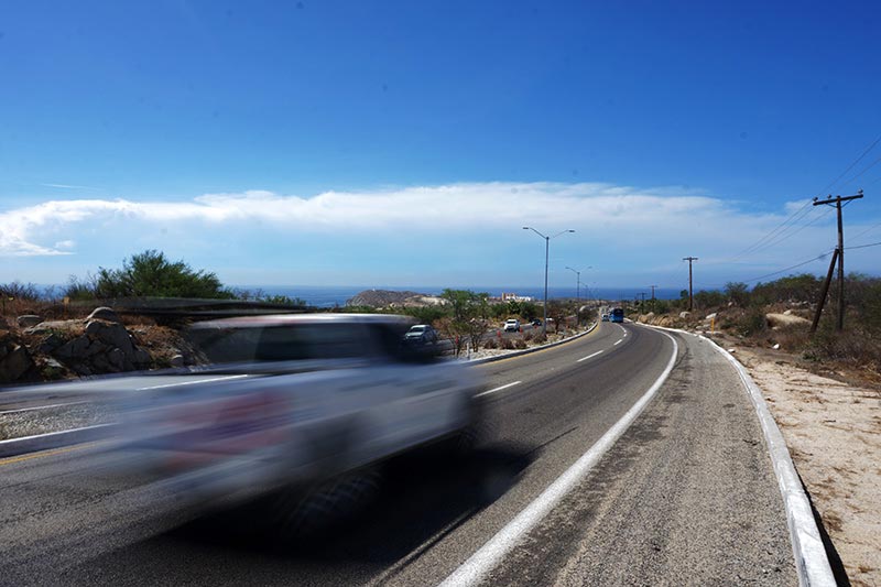
Much of the road from San José to Cabo San Lucas felt like this!
Even with our research, we still arrived in Cabo San Lucas without a concrete plan of where to stay. We made our way to one hostel and although they had a room available for us, we were told that we’d have to leave our bikes in the common area. Not ideal. Fortunately, there was several hours before we could check in so we used that time to first, refuel with some food and drink, and then later, to do some shopping for other hotel options.
As we stopped outside of a taco shop to discuss our options, the friendly shopkeeper asked us what we were looking for. He then proceeded to list several hotel options in the neighborhood, not all of which were listed on the web. As it turned out, after a bit of riding around, visiting several different hotels to price check, we found a gem of a place very close to the popular neighborhood. For only 500 pesos, about $29.00 US, we got a room with AC, Wi-Fi, a fridge, coffee machine, and all in a pretty new building. Score!
Trip Stats:
- La Ribera to Cabo Pulmo: 32.3 km, 4:15 hours
- Cabo Pulmo to San José del Cabo: 66.2 km, 9:33 hours
- San José del Cabo to Cabo San Lucas: 32.7 km, 2:28 hours


Hey Mike,
I know from experience of spending tons of hours to make a video seem really cool and exciting and then only get crickets after I post it seems kinda defeating.
I read all your blog post back from the beginning and really do appreciate the time I know you spend to post them.
Keep up the good work, I’ll always be a fan of you and Rebecca.
Cheers Mike.
Thanks very much, Mike! Yes, it’s nice to get feedback, especially when you invest a ton of time in a post, video, etc. I’ve come to realize that good news and pretty pics seldom creates traction on a post, only real drama does. Rather than seeking out drama, we continue to share as much for ourselves as for anyone else. That said, reading the comments that we do get does still motivate me to put effort into the task of maintaining this website. So thank you!
You are both amazing. Congratulations on making such a life style choice. Thanks for sharing your story Colin
Amazing is likely stretching it, a lot, but thank you! I appreciate the kind words! 🙂
Hi there,
I am curious. Have you thought about the existence of the “cartels” and other miscellaneous gangs while cycling in Mexico? You seem to have met good people so far, but I hope you take some precautions. I was thinking that maybe that is why that man at the store wasn’t so friendly, but then, maybe he was just having a bad day.
Val
Or maybe he just didn’t think it was going to rain and I read more into our “not speaking the same language” conversation? 🙂
Do I think about the drug cartels? No. I don’t buy or sell drugs, nor am I a reporter trying to bring light to their somewhat-hidden business, nor am I a police officer, or a politician, trying to shut down their business. For these reasons, I’d say our risk is minimal. I have a lot bigger things to worry about, like fast moving cars that don’t stop at Stop signs, or running out of the water in the middle of the desert.
Nice job you two! Quite the accomplishment. Thank you for sharing your trip.
Gracias, Javan!
Loved the write ups and the detail. Have read and more or less studied every one of your posts, just such an awesome journey. Even looked at your InReach track a few times as you moved off the Baja Divide route ( for Tour Divide they call that a “blue dot stalker” … looks like a green dot for the InReach page 🙂
Land’s End ! Was just reading Steinbeck, him talking about those rocks. Keep the pedals turning !
Thanks, Mike. I’m glad someone is looking at the InReach track. I’d much rather it be used for stalkers than to call out for help in the event of an emergency! 🙂
Mike, hi to you and Rebecca. I do enjoy the long posts (although this is a good max length). And, you started and ended with a still unanswered question of mine – coffee. How do you make it (or forgo making it) when you are not someplace with a coffee pot?
Dave
Hi Dave
Rebecca and I have never been coffee connoisseurs. We simply like our coffee hot, strong, and black. That said, I’m still almost embarrassed to say that we resort to using instant coffee while camping. It just takes too much time and energy to do otherwise. Today we got our coffee from an Oxxo store (like a 7-11). It was much better than instant!
Congrats on this milestone! I hope you rest up and drink much. Just reading these posts makes me thirsty. I’d try and find some high vis shirts or something like that for riding in that traffic. Be careful.
For highway riding, hi-vis shirts, and daytime blinking lights would be beneficial. We just don’t do enough of it to add to our kit though. Hopefully that remains the same for our future travels.
Hi! Enjoyed your sailing adventures for the great tips and now, biking for the travel. Thanks for your efforts. Keep up the good work!
Thank you, Ellen!
Oh man I was worried when I read “dive shop”, after hitchhiking from Los Frailes (the pretty bay south of Cabo Pulpo) we ended up there. Luckily we only order a beer and chips – but still had the jaw dropping experience when the bill came. We did dive with them and that price was more competitive.
Hi Chris. Glad to hear that. We’re happy to be back in La Paz where more affordable options are available.