Our Nicoya Peninsula beach vacation

Promises of secluded camping spots and scenic beach riding are what led us from the inland city of Liberia to the Nicoya Peninsula, a 121 kilometer long stretch of land jutting out from the Pacific Ocean side of Costa Rica. The route we intended to ride is well traveled, having been published on Bikepacking.com some time ago and followed by many cyclists since that time. We had a GPS track from Bikepacking.com as well as one from our friends Mark and Hana who had traveled the route back in December 2017. At the time, presumably, because there was still a lot of water on the trails, they had been forced to make some small variants to the published route. Would our trip be similar to theirs? We would soon find out.
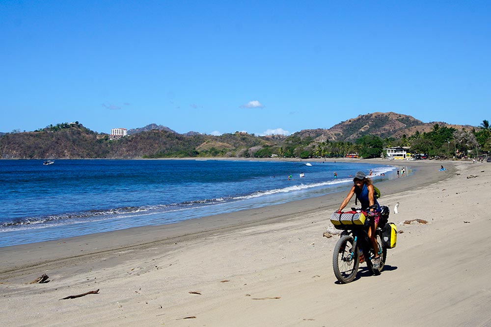
We made excellent time when leaving Liberia, exiting the city on a paved highway with a strong tailwind propelling us along. When we reached the foothills separating us from the coastline, our paved highway gave way to gravel. It was here that we first experienced the dust that the peninsula is notorious for during the dry season. The published route directs riders to the coast on a gravel track known as the Monkey Road. After crossing a couple of small streams, we took the first of Mark and Hana’s route deviations, leading us on a lesser-used road that we later learned is called the Donkey Road, and for good reason.
I kidded Mark later that day saying that as wonderful as his blog is, he continuously downplays issues that we consider to be significant. For example, in this case, he referred to this track as being “a bit steep” in certain places. As we struggled to push our bikes up the slippery-from-the-loose-gravel incline, there was no doubt in my mind that I would classify the road as more than a bit steep! In fact, I even had my first wipeout in some time on the back side of one of the steep hills, skidding out in the gravel and dropping my bike. Nothing was broken on either my body or my bike, so all was well and we carried on.
Hard sand is fun to ride on.

Soft sand, not so much.
Our plan had been to stop at a grocery store to pick up some food for dinner just before we reached the beach that we hoped to camp on. Unsure of where the store was actually located, we pulled over on the side of the road at one point to discuss it. Rebecca tells me that she let me know that she was going to check her GPS to find it and assuming that I had heard her, proceeded to check her phone. Apparently, she had a one-way conversation with me about the store, letting me know that we had already passed it. I, unfortunately, had never heard her say that she was going to do all this and so, while she was trying to tell me the details of the store’s whereabouts, I was busy pedaling away down the highway. I only found out about all this when an out-of-breath Rebecca finally caught up to me some distance down the road. Quite funny at the time. For me. 🙂

We made it to our first camping spot on the peninsula.

Cleaning the fish that our new friends had gifted us.
After making our way back to the store, we experienced another bit of Costa Rican courtesy. Two gentlemen were sitting outside the store, enjoying a cold beer, and when Rebecca went inside to do her shopping, they struck up a conversation with me. Santiago and Pepé, both originally from Spain, were intrigued by our bikes and my stories of our trip. As they had just returned from spear fishing, they offered to give us one of the fish that they had caught just an hour earlier. Not one to look a gift horse in the mouth, or in this case, a gift fish, we, of course, said yes. Ceviché anyone?
Our camping spot that night was tucked in the trees on a long, white sand beach. When we first arrived, the beach was packed with people but as expected, when dusk fell, almost everyone returned to their homes or hotels, leaving us alone. Much like on our first night in Costa Rica, we enjoyed a quiet evening together. Rebecca prepared dinner by the light of her Mantus headlamp and once we had finished eating, we relaxed while watching the waves break onto the beach until the tiredness from the day’s ride caught up with us.

Watching the waves break onto the beach.

Preparing dinner by the light of her Mantus headlamp.
Early on the next day, we came to the second of Mark and Hana’s route deviations. It occurred shortly before a spot where we would be required to cross a couple of rivers and since it was now well into the dry season, I had hoped that we’d be OK with the shorter and more direct original route. When we came to the first questionable part of the track, I left my bike and scouted ahead for some distance before suggesting that we commit to moving forward. Unfortunately, I did not scout ahead quite far enough.

The day started off easy enough.

Smarter people would have turned back at this point.

Dropping down into the creek bed, aka the trail.
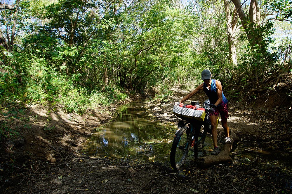
It’s early in the day so she’s still trying to keep her feet dry.

Making slow progress.
You can pretty much be assured that if I even say something like “It’s only 7 kilometers…” something bad is about to happen. That’s pretty much what occurred then. We pushed our bikes through a muddy creek bed, deeply trodden by cows. We were moving slowly but we were still making progress. That is until we came upon an area reminiscent of Hollywood quicksand. In fact, that is exactly what was going through my mind as I sunk almost to my knees in the thick mud and my bike along with it. No, there would be no moving forward on that track.
Hollywood quicksand!

The fences are for cows, not cyclists.

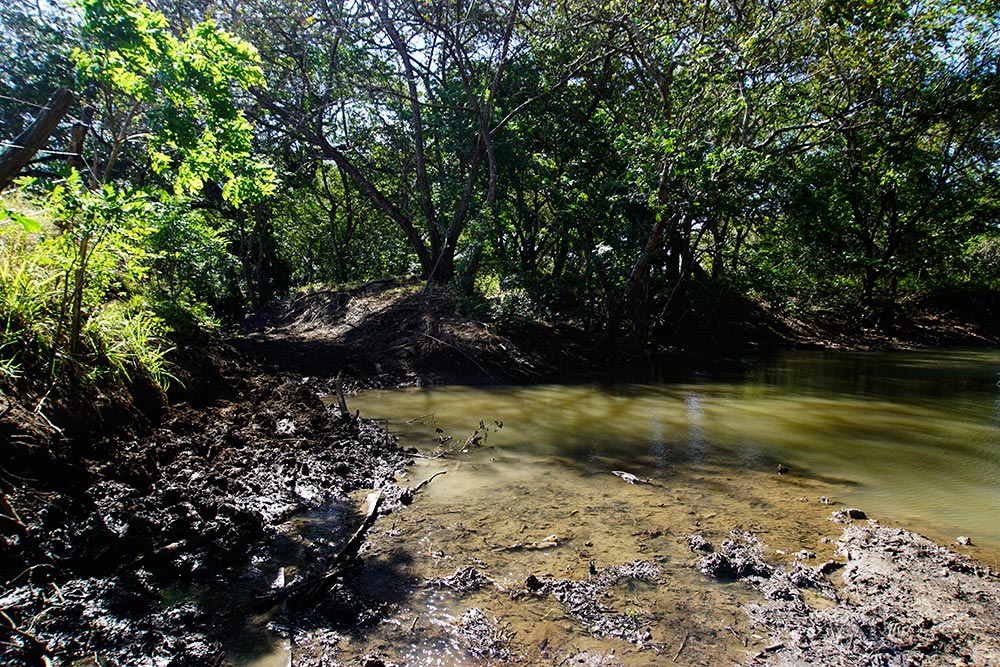
One of the two creeks that we had to cross. Not much water.
Taking an alternate route through the adjacent pasture required first finding a way to get on the other side of the barbed wire fence bordering the creek bed trail. We managed to do it, but it was not easy, and as you can imagine, when we finally did make it to the next town, which was “only 7 kilometers” away, we had taken significantly more time than we had initially expected.

Pretty in pink!

I have no explanation!

Washing the quicksand mud off my legs while keeping an eye out for crocodiles!

Easier to cross this with a bike than with a car.

The kind of traffic that we don’t mind.
Our camping spot that night was adjacent to the Ostional Wildlife Refuge which, according to Wikipedia, is one of the 2 most important nesting grounds for Olive Ridley Sea Turtles. We pitched our tent in the backyard of Hilbert, an advocate and protector of the turtles in that region for close to 30 years. Although there were no turtles present during our time there, he showed me some videos of what the area looks like when the adults arrive to lay their eggs, and when the babies are making their way to the ocean. The footage was incredible!

View of the beach from our camping spot in Hilbert’s backyard.
Day three on the peninsula is where we really got a taste, and I mean that both figuratively and literally, for the dusty roads. The gravel tracks are much more traveled than I had imagined and with every car, truck, or motorcycle that passed us, we were engulfed in a cloud of dust. Some had suggested that we cover our faces with a bandana but when struggling for every bit of oxygen that we can get while working our way up the sometimes-steep hills, I find a face mask a hindrance. As you might imagine, the fast traffic left me cursing on more than one occasion.

Solid advertising. 🙂

Traffic jam.

There is no escaping this dust.
Having had so many cars and trucks pass us with little care for the cloud of dust that they covered us in, it was my intention to try to catch a photo of one of the inconsiderate drivers. With a car approaching from behind, we stopped on the side of the road and I got my camera ready, only to have the car pass us at a respectable speed. Surprisingly though, just after going by us, the car pulled over to the side of the road and stopped. And then it started backing up towards us. And then the occupants got out. Who was in the car? A young couple that had been in our group when we hiked to the top of Volcan Acatenango back in Guatemala. How they recognized us while driving by, I don’t know, but they did. Small world.
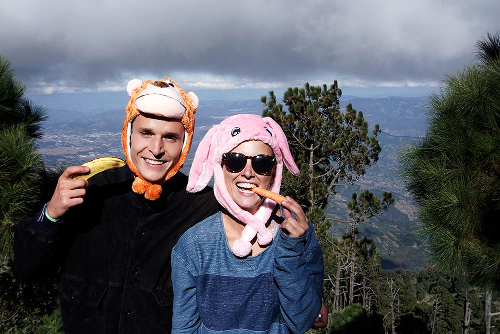
Hiking companions on Volcan Acatenago. Love their hats!
View from our campsite in Samara.
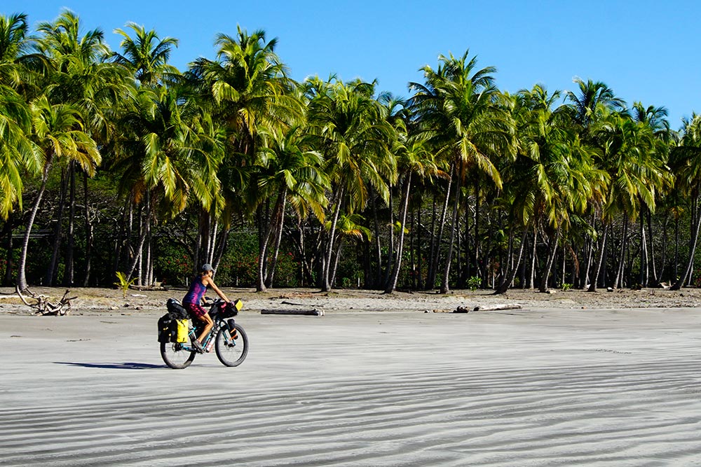
After paying for a spot to pitch our tent in Samara, we spent that night, once again, camped adjacent to a beautiful coconut-tree-lined beach. Even though my prior research had led me to believe that Samara was a less-well-known beachside town, it appeared pretty touristy to us. Although our campsite wasn’t as remote as some of the others that we have enjoyed, we were literally only feet away from the beach and thus were able to jump in the water to cool off at our leisure. It was a good spot.

Our chains were replaced in Liberia. We work hard to keep them clean each day.

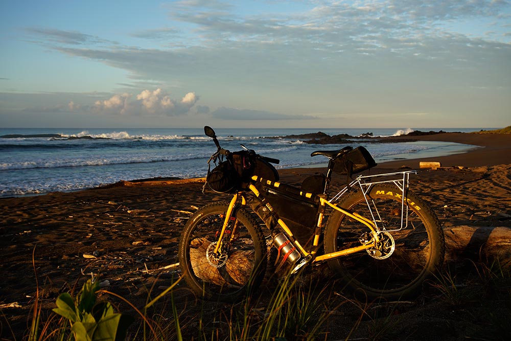
Glamor shot of my Tumbleweed Prospector and Rogue Panda bikepacking bags.
The following day was our toughest day of riding on the peninsula and in spite of starting out great with a bit of beach riding, our least enjoyable. As beautiful as the coast is, there’s nothing scenic about a gravel road where everything within 10 feet of each side of it is covered in a half centimeter of dust. That road reminded me of some of the stretches that we followed in Baja albeit with a lot more traffic. The day’s ride also included a significant amount of rolling hills, some of them so steep that we were forced to push our bikes instead of riding them. No, not so enjoyable.
We ducked off the road to ride this nice stretch of beach.

Near perfection.

Purple flowers (weeds) spotted while bushwacking with our bikes.
We failed to find the trail so had to return to the road on the other side of this river.

One of the great things about Costa Rica is that we can once again drink water from the (most) taps instead of being forced to purchase it in plastic bottles and bags. I think that in villages where not all houses have water plumbed to them, the AYA has installed taps (image above) for the residents (or thirsty cyclists) to acquire water.

Taking a break on a steep dusty climb.
Around the middle of the day, just after coasting down the backside of one of those long steep hills, we came upon another cyclist heading in the opposite direction. Tanguy shared that he had just recently started his trip in Panama and was on his way to Cancun. We passed along the unfortunate news that he had a couple of very long climbs ahead of him. He appeared to be traveling with what looked to be a fairly light setup so perhaps he had an easier time with the hills than we did. I hope so.

Tanguy is cycling from Panama to Cancun.
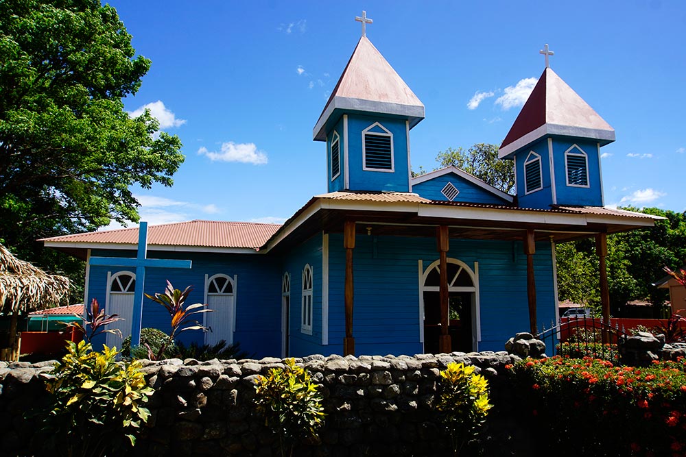
Cute church. We stopped at a nearby store to rehydrate.

A shy little armadillo.
Everything within 10 feet of the roadside is coated in dust!
There are not many things better than having an entire beach to yourself and that’s exactly what we had that night, camping at Playa Caletas. Knowing the tide would be higher than normal due to the Super Blue Blood Moon, we made sure to pitch our tent well back from the high tide line. We did have one or two vehicles pass by early in the evening on a nearby road, and another couple arrive on a motorcycle to watch the sunset. After they left though, we had the place to ourselves. It was just us and a thousand little crabs scurrying along the beach, illuminated only by the full moon.

Sunset at Playa Caletas.
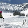
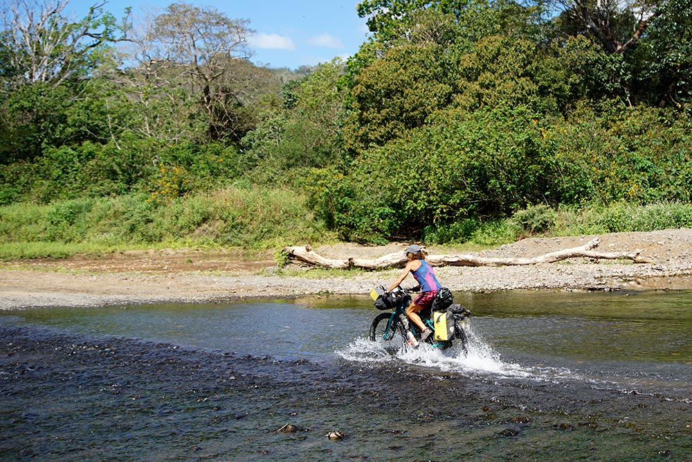
The next day was the one that we had been most looking forward to. The route description indicated that we’d have some great beach riding that day, and it was right, we did. As luck would have it, without making any alteration to our schedule, we arrived at the beaches right at low tide, a requirement we had read for navigating that part of the track. We also crossed a couple of rivers that for us, having the ability to pick up our bikes and carry them if necessary, ended up being no problem. The tourists that we saw at the first one pondering how they might get across in their non-4×4 vehicle might have had a different experience.
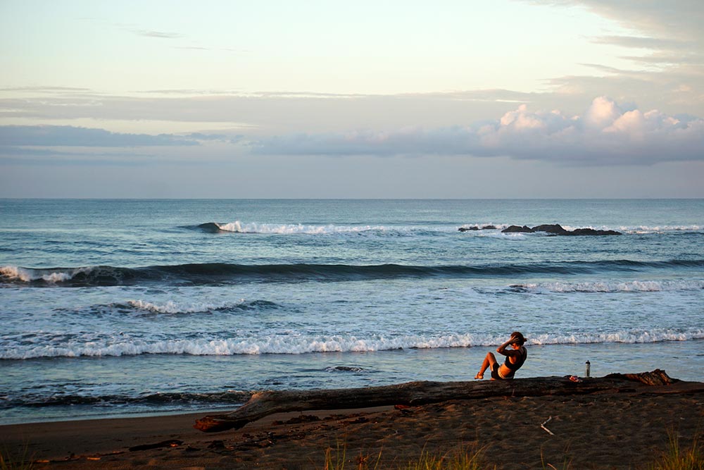
Rebecca is up early each day to exercise.
My bike enjoying the view.

Almost ready to ride?

Our campsite at Playa Caletas. We had the beach all to ourselves.

Making our way from the beach back to the main road.

Off route but we just had to get a photo with this amazing tree!

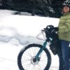
It is often necessary to scout the rivers to find the best spots to cross.

Now, this is what I’m talking about!

Our bikes are enjoying the beach riding.

We still have time to play around.
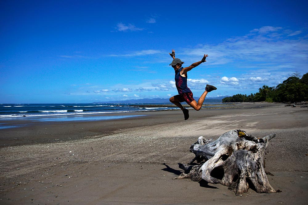
Jumping for joy?

All smiles!
The second reason why we were most looking forward to this day was that we had hoped to meet up with an old sailing friend, Maureen, who now resides near the town of Mal Pais (Bad Lands), our destination for the day. Because much of the days riding had been on the beach or near sea level, we made good time getting to Maureen’s area. When I messaged her to let her know that we’d arrived, she asked if we’d simply like to come “up the hill” to her house. The directions included, among other things, that the house was near the “green water tower.” “Up the hill” and “water tower” were all the clues that I needed to know that our chilled day of riding was about to end. Yes, pushing our bikes up the hills to get to her house was a huge slog, one that involved several rest breaks and much swearing. Fortunately, I have a very short memory for bad things and the pain of the hill was largely forgotten once we saw her smiling face.

A nice dirt track parallels this stretch of beach.

Left: The day that Strava was on drugs. Right: The climb to Maureen’s house.
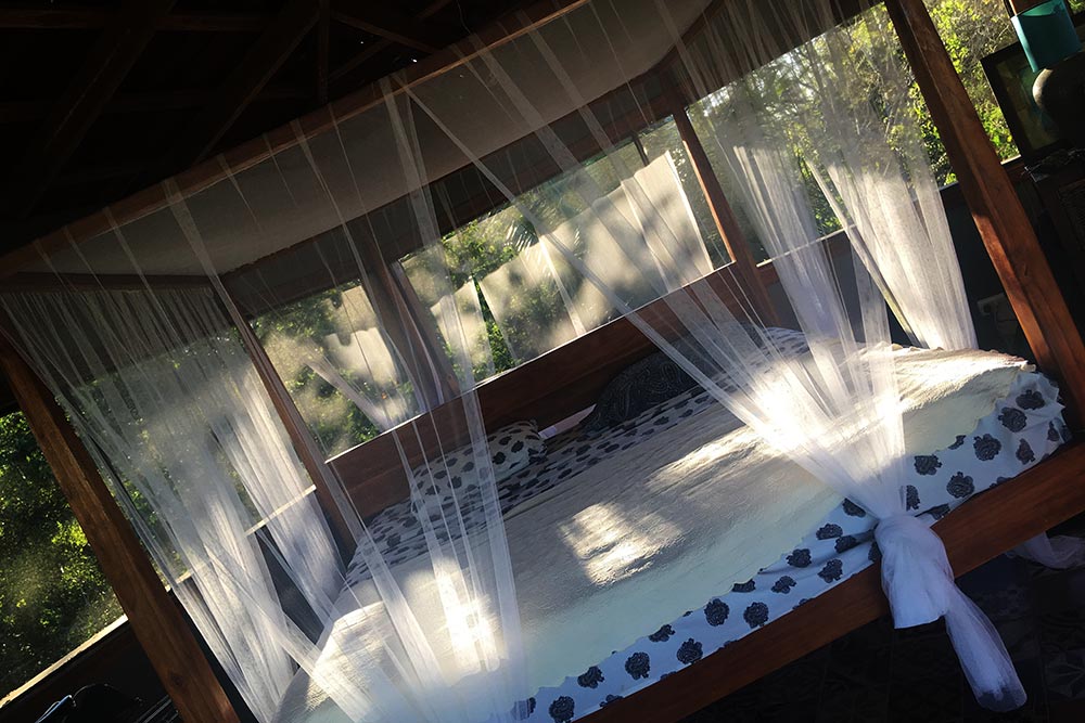
As much as we enjoy camping, this king-sized bed in the tree-top-high room in Maureen’s house is better!

Watching the sunset on the beach, just like the old days.

Goodnight, Sunshine. See you tomorrow.