The joke continues
In at least a couple of posts previous to this one, I have drawn parallels between Georgetown in the Exumas and Grenada. I noted that both places are turning points of sorts where people either, after waiting a certain period of time, do a 180 and head back where they came from, or venture on to parts unknown. In order to move beyond these points of course, one should have in their possession the necessary navigational charts to be able to do so safely. I wrote how we unwittingly became part of what we thought was an inside joke in Georgetown, that being, members of the community of sailors who showed up in GT without the necessary nautical charts to venture further.
Grenada is again, just such a turning point. Of course, many people do go south to Trinidad and then head back north, but I am referring more about those vessels that set sail west towards the ABCs (Aruba, Bonaire and Caracao) and beyond to the Western Caribbean. We have had several friends who have gone on to do this (check out our friends Happy Times for great details on their adventures) and although we’ve put it temporarily on hold, even considered that path ourselves. It’s a good thing we put it on hold too because we, like the numerous other cruisers we hear on the radio net in the morning, are again without paper charts to travel further. We do have the Garmin SD-card for the Western Caribbean which puts us in much better shape than we were in Georgetown, but we’d still prefer to have a backup before we venture in that direction.

I know it is still relying on a computer, but what about simply downloading raster(vector?) charts. Yes still not paper, and I agree with you on having paper, but at least a decent backup when attached to a GPS puck.
Yeah, that is a no brainer. We have computer charts for many places. We still like paper charts though.
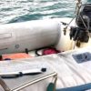
Gorgeous picture!
bob
Thanks, Bob!
Hi Mike and Rebecca
Love your blog and look everyday (a lurker). I wonder what your long term sailing goals are? Ie. do you plan one day to go through panama to the pacific or venture across to the med. Or is the carribean as far as you go? (you seem really happy there).
Keep up the brilliant blog
Mark
Hi Mark
I’d love say that I have an answer for you but I don’t. All I know is that for this season we will “likely” remain in the Windward and Leeward islands.
Thanks for the shout-out!
De nada, Amigos.
If all you want is a paper chart so you still have charts if the computer is unavailable…. cant you print them?
I have nothing to print. We only have the charts on our chartplotter.
Just wondering why having paper charts is a priority… are there often discrepancies between the digital charts and the paper charts in that area? It would be good to know, if that’s the case.
We find that our chart plotter is not detailed enough for our liking for new territories. However, we have an app we use on our iPad and iPhone called NavX that we’ve found to be just as detailed, if not more sometimes, than our paper charts.
Digital charts are only reproductions of the data which has been previously printed on paper. Their accuracy depends solely on the data/survey that they are based on. Most surveys are quite old. While the cartography on our Garmin charts has been 99.9% spot on, we have heard that other brands are sometimes not quite so good. Note that your iPad apps are no different than marine chartplotters, their representations are based on the same surveys.
Why do you need paper charts? You may not, unless you lose all of your electronics in a lightning strike or some other calamity. Pretty expensive insurance if you have a chartplotter and a backup or two but we like to have them on hand. Redundancy!