Sometimes we get carried away
What started out Friday as a simple hike to the top of one of the peaks bordering the Simpson Bay Lagoon morphed into a 16 km journey all around the lake. Yes, sometimes we get a bit carried away.
The other day we received some beta on a trail to the top of Sentry Hill from none other than Caribbean guide book author Chris Doyle and as one might expect, his directions were extremely accurate and helpful. Once on top of the 340 m high peak though, we were nowhere near ready to turn back, especially with other peaks beckoning to us.
The trail that we had been following continued all along the ridge line and so we carried on, enjoying the walk while alternating our focus between the picturesque views in the distance and the prickly plants around our feet. Once we made it to St. Peter’s Hill, the trail stopped and we were faced with a bit of a decision: return back to our starting point the way we came or begin walking down the steep access road to look for another route back to our dinghy. Of course, we now know that the first option would have been the easiest and shortest of the two. While it was only 5.47 km from our dinghy to that spot along the trail, by choosing second option, we would end up walking almost 11 km more on our return trip to Cole Bay where we began the trek. We definitely got some exercise that day!

And so it begins. The walk up the steep hill at the beginning
was one of the most tiring parts of the hike!
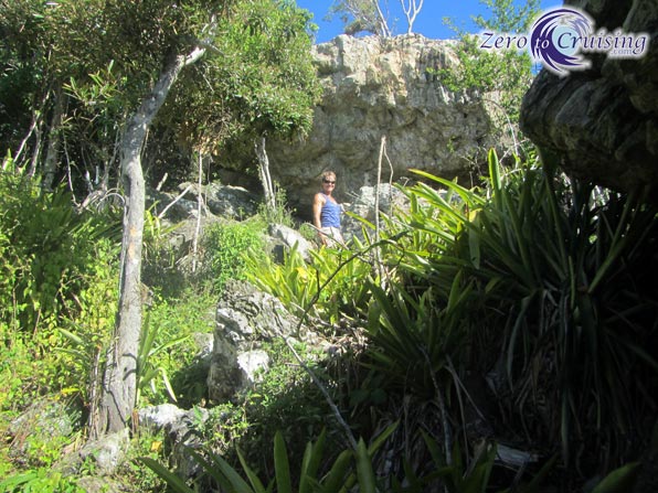
The trail was easy to follow and only involved a bit of scrambling.

Philipsburg and the Great Bay Salt Pond in the distance.

Amazing views.

Almost to the top of Sentry Hill, our initial destination.
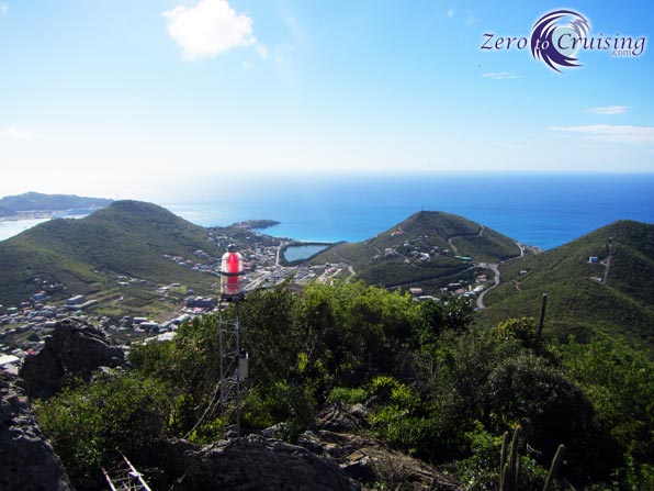
One of the red lights which we can see blinking from our boat.

The highest point. Wasn’t that nice of them to leave a little ladder leaning against a rock for us?
No, it was not attached!

Can you see our boat?
360 view from near the top Sentry Hill – St. Maarten. The video is a bit shaky because the camera was handheld and I was turning around on top of a rock, trying my best not to fall to my death! If I had tried to do this from the actual highest point of Sentry Hill, I surely would have. 🙂

Great spot for a picnic!

And the trail continues…

The hill with the thing on it which looks like a lunar lander is our next destination.

We were following this stone wall for a large part of the hike. I don’t know why it was constructed.

Ever higher.

St. Peter’s Hill. 317 m high.

5.47 km, 2:15 hours to this point.
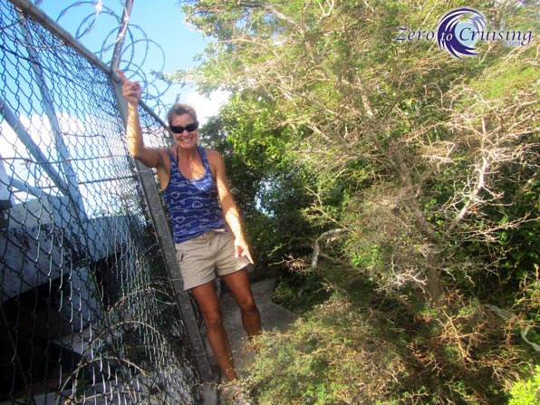
We found it amusing to see that the tower was guarded by concertina wire on the inside and nails, the equivalent of natural concertina wire, on the outside.
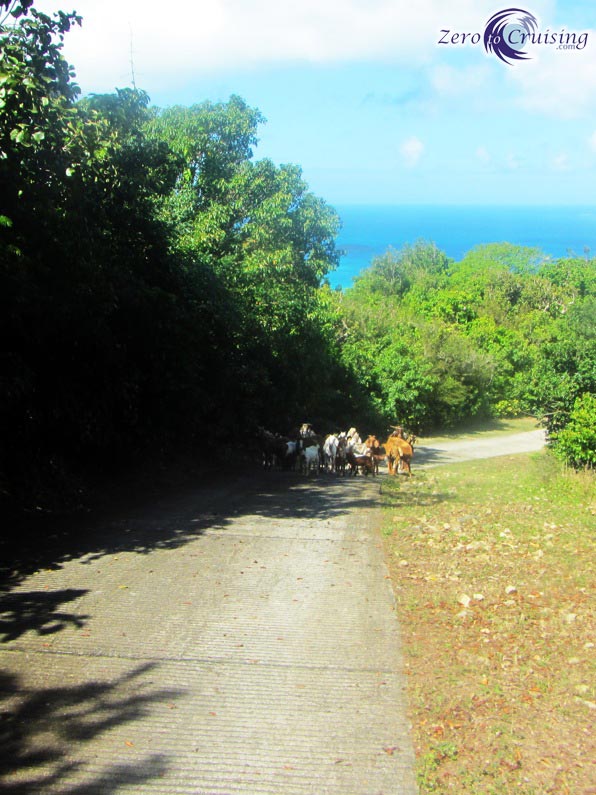
We had a stare-down with an unattended herd of goats on the way down from the hill.

On our way back we crossed the border between the French and Dutch sides of the island.

The entire hike was 16.1 km, much longer than we had initially planned on doing!

I believe the stone walls are retaining walls from agricultural terraces left from the 18th and 19th centuries. Link below:
http://www.guidetocaribbeanvacations.com/st_maarten/SucreParadis.htm
I’m not sure if this is your trail or not, but it would stand to reason that the ones you passed would be from the same period for the same reason.
Thanks for the great photos. I got winded just reading about your trek.
I supposed you could be right. That was not the trail we were on but it stands to reason that the walls could be for the same purpose. We had initially thought that it might be the wall between the French and Dutch sides but it’s not in the right spot. The wall seemed to be going, more or less, vertically up the hill as opposed to horizontally as I would assume a terrace wall would.
For your US readers — that’s over 9 miles. I could have handled the distance – but not your pace – and I would have freaked at the loose ladder.
Great post and photos. Thanks.
10 miles to be exact. I could have posted that but I thought 16 km sounded better. 🙂
wow, beautiful views!
Quite different from where you live.
The next time you run into that herd of goats, just sing this song to yourself and you will be all right…… “I Ain’t Afraid of No Goats!”. I think it was by Ray Parker Jr.
🙂
I’m not familiar with that song.
I know you’re joining but for the record, we were not afraid of the goats. Goats are EVERYWHERE down here. We were actually just trying to not scare them and have them run back down the hill. We wanted them to be able to continue on to wherever it was that they were going.
Actually, the name of the song is “Ghostbusters” from the movie Ghostbusters. One of the memorable lines that is repeated is “I ain’t afraid of no ghosts”. Kinda hard to get the humor across online. Oh well.
🙁
Communication via text is so tough sometimes. Sorry.
Nothing wrong with getting a little carried away- looks like the view was worth it! Hope you got to take a cool dip soon after.
Wonderful views! I’m really diggin’ the rock structures, also.
Makes me wanna get my climbing gear out and revive that part of me. Thanks!
Mike
http://www.siochana.us
I actually have my rock climbing shoes with us on the boat although I have never used them. We do use my harness for going up the mast though.
Hi Mike. I am new to your site. Impressive pictures of St. Martin. I was curious. You have been cruising for over 900 days. Of those 900 days, how many days do you estimate that you were actually sailing enroute to a new destination versus days spent moored or anchored in a port, exploring a new island destination or waiting for a weather window? I have read that most cruisers spend 90 to 95% of days in port versus sailing to a new destination. Do you agree? Perhaps more reason for the growing popularity of cats and their spacious interiors for live aboards. Enjoy your site and look forward to reading your older posts. Thanks!
I definitely agree. I can’t give you any accurate stats but it’s got to be close to 95%.
I have a future blog post planned that is somewhat along this theme.