Rainy day exploring
We had virtually no expectations when we arrived at Statia and that is almost always a great starting point for an island visit. The Customs office was, surprisingly to us, open on Good Friday and the officer who looked after us was courteous and friendly. We completed one form and without taking any money from us, stamping our passports or giving us any documentation at all, he told us to have a good day and to report back the day before we intend to leave so that we could pick up a clearance form. The weather on our first day here was less than great so we spent it quietly on board, napping and recovering from our passage.

Unfortunately, the rain and clouds have persisted. While, in many cases, we might be tempted to remain aboard ZTC in weather like this, staying dry and perhaps watching a movie, in this case the overwhelming urge to get out and explore, which inevitably follows a long(ish) passage, won out. Although we expected that we would end up being rained on for much of the day, we had to get off the boat.
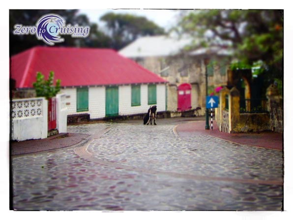
As we walked along the road bordering the coast, we saw many people erecting tents and pavilions which we came to learn was in preparation for their Easter celebration. Monday is reportedly the big day. The only map of the area that we had was an image downloaded from the internet so we asked a couple of guys working on one of the structures for directions to The Quill, the dormant volcano which dominates the island. Although it was looming right in front of us, we still needed to find our way to the trailhead. With a smile they pointed us on our way, up the “slave path,” past the church and the fort. From there on we could follow the signs which were conveniently placed throughout the postcard-like town.
There are several trails that one can hike around The Quill but because the mountain top was shrouded in rain clouds, we opted to do the long “around the mountain” route instead of taking the trail to the very top. The path was indeed long but reasonably well marked and maintained, making for fast hiking. With the leaves on the ground and the rain falling from the sky, we were reminded more of an autumn day back in Canada than a spring day in the Caribbean. When all was said and done, we ended up completing a 7.1 mile hike (from the dinghy dock and back to it). We plan to do the trail to the top of the mountain and down into the crater on a day with a bit more pleasant weather. In addition to that motivation, we’re keeping our fingers crossed for the weather to improve as we’d really like to see the festivities that the locals have planned for this weekend.
- Note: While in the process of typing this post we were boarded by the Coast Guard for a routine inspection. Like the Customs officer who cleared us in to Statia, the two gentlemen who came aboard our vessel were professional and friendly.


I hope you are going to find out why “Tumble-Down-Dick” bay is so called.
Google maps show it as an oil and gas storage area or something. But a name like that must have an interesting origin. 🙂
Mike
Looks very nice! Hope we can stop there.
Wow that’s quite a hike, just getting up the path from the old gin house to the town was enough for me…….