Que le vaya bien
Que le vaya bien. This expression is called out to us numerous times each day as we pedal along the Mexican backroads, or leave the tiny stores that are an integral part of the pueblos that dot the countryside. A Google search says that the expression translates to “I hope things go well for you,” and it’s one of the things that I’ve come to love about cycling through Mexico. Perhaps it is just the equivalent to our “Have a nice day,” said without a lot of thought, but I like to believe that it means more than that. It seems to me that the majority of people we have come in contact with here in Mexico, especially in the rural areas, are sincerely hopeful that our journey through their country is a good one. They have little to be concerned with. It’s been entirely positive!
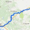
As I noted in our last blog post, our route from Cholula to Oaxaca, where we are now, was anything but set in stone. We had a loose plan, based upon some Google routing suggestions, but the only thing we had really set in our mind was that we wanted to make it to Tehuacán on the second night of the journey to meet up with Obed, a member of the Couchsurfing network, who had agreed to host us for the night.
We set off riding from Cholula in the cool morning air with several layers of clothing on to keep us warm. As has become a common occurrence, we had our breakfast with coffee while sitting on the sidewalk outside an Oxxo convenience store. We had been riding along roadways congested with morning rush-hour traffic but that ultimately receded as we exited the city. It wasn’t long before the sun would make our extra clothing unnecessary. With clear skies overhead, the peaks of the volcanos Popocatépetl and Ixtaccíhuatl that we saw up close several days earlier remained visible for some time as we pedaled south.

Similar to a 7-11 in the USA.
One of the few times that Google tricked us off the paved roads that day.

A clear view of the volcanoes in the distance.

We were recently reminded of the opening scene of a James Bond movie that was filmed in a spot that we recently visited. Can you name the location and the movie? No cheating!
Our first day of travel found us riding primarily on paved roads which although not typically our preference, did allow us to cover some significant (for us) mileage. We had no solid plans for where to spend our first night and our route wasn’t taking us through any larger towns where a hotel was guaranteed. As luck would have it, just about the time we were ready to call it quits, a rusty sign advertising a hotel teased us off the main road into the small town of Atoyatempan.

I am not religious but I do appreciate the architecture of the churches.
Waiting for “traffic.”

A large aqueduct passes over the road.

Open or not?
The hotel in question was on the far outskirts of the town and at first sight didn’t give us a ton of confidence that it was open. It was of the autohotel variety with a large wall surrounding the premises, and the painted sign on the concrete block wall was old and faded. When we saw a motorcyclist delivering tortillas to someone at the gate, our hopes were bolstered, and even more so when he assured us that yes, it was a hotel, and yes, it was open. As it turned out, the hotel was perfect. We had a nice big bed and hot water, and there was a seating area in the lobby where we could eat our dinner and relax. Additionally, that place now holds the record for being the cheapest hotel we have stayed at: only 150 pesos, which is less than $10.00 US!

Colorful sign at the entrance to Atoyetempan.

And an equally colorful church in town.
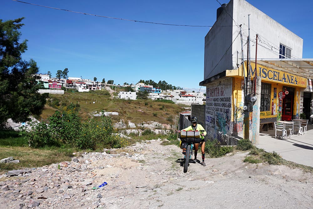
The next day, we set off towards Tehuacán. Unlike the day prior, we enjoyed riding on some quiet dirt roads for a good portion of the day. Unfortunately, venturing off the main roads comes with its own set of risks. The number one being that the trail we are following will at some point end up at a dead end, forcing us to retrace our steps. This happened twice that day, the first only about 30 minutes into our ride when the track we were following disappeared without warning.
Just before doing a 180 and retracing our steps.
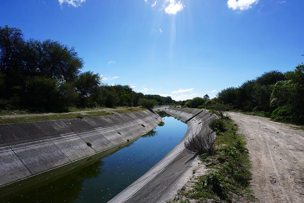
We followed this irrigation canal for quite some time.
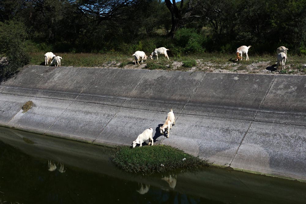
The goats seemed to like it.

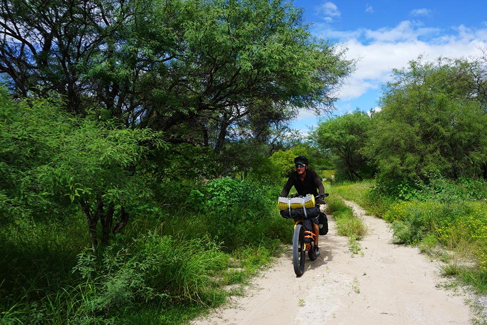
Pleasant afternoon riding.
The second backtracking situation occurred near the end of the day. The dirt road we initially started following turned gradually from a nice gravel road to a two-track path, to single track, to overgrown bush. We may have been tempted to try to bully our way through the brush had we not found ourselves surrounded by large spiders. Now, I’m not talking one or two spiders. I’m talking horror-movie quantities of the creatures. Spiders and I are not really on friendly terms so when I took a couple of webs in the face as I pedaled down the path, I was less than impressed. When I stopped and saw that we were actually surrounded by spiders, I had no qualms about backtracking a mile or two and riding on the highway the remaining few miles into Tehuacán.
Love the dirt two-track roads.

Do NOT love spiders!
Our host in Tehuacán was as gracious as we have come to expect from our Mexican acquaintances. Our host’s son gave up his room for us so that we’d have a nice bed to sleep on, and we were invited to share dinner with the family. Obed, our host, also set us up to watch a number of Mexican travel videos, highlighting some of the areas that he felt were worth a visit. When we shared our prospective route from there towards Oaxaca and he pointed out that it had us traveling primarily on the large toll highway, it got us thinking.
I mentioned in my last post that our route towards Oaxaca was definitely open to being changed. With some pesky mountains standing between us and our destination, it seemed as if we had two main choices for routing. The first was the toll road. On the plus side, the toll roads typically have a generous shoulder to ride on, and that route would have involved “only” a couple thousand feet of climbing. The second option, on what we hoped was a lesser-used roadway, would first start off with a huge descent down to approximately 1500 feet, a loss of over 3000 feet. It’s worth noting that we haven’t been anywhere close to that low since our first day after leaving Baja. With a mountain still in the way, dropping down that far could only mean one thing: an even larger climb. While just a week earlier we had been concerning ourselves with the 4000′ climb over the Paso de Cortés, here we were contemplating a climb that was one and half times as large! Can you guess which one we chose?

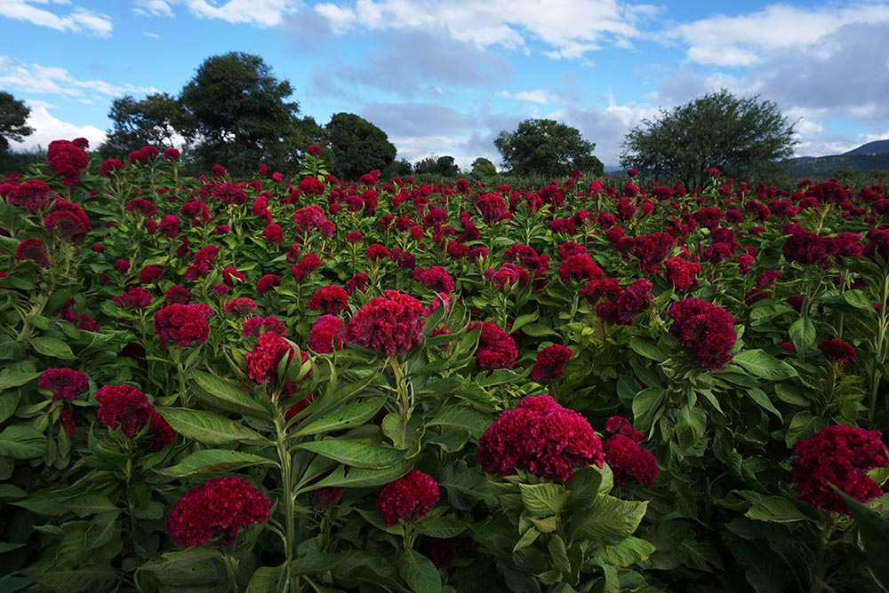
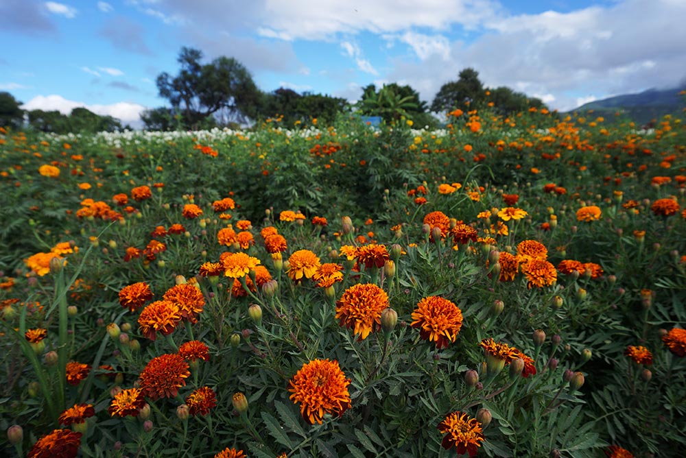
Colorful flowers everywhere, both wild and cultivated (like these).

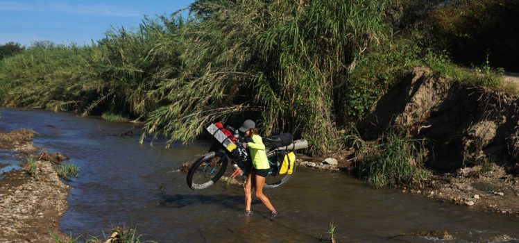
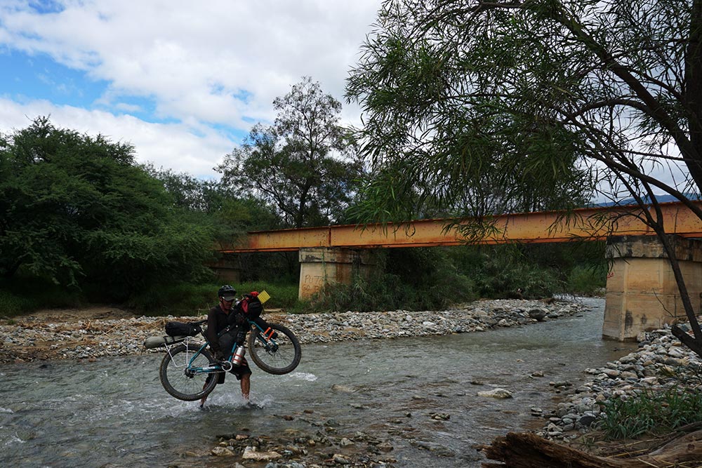
The downhill ride out of Tehuacán could only be described as epic. After stopping at a random restaurant to fill up on one of the best breakfasts we have had in Mexico, we started our descent in earnest. The majority of the day’s riding was on dirt tracks weaving their way through agricultural fields. To add to the adventure, our route, again derived from Google Maps‘ “walking” option, left us to carry our bikes across no less than four streams, each swollen from recent rainfalls.

Low-hanging clouds.
Not today, my friends.

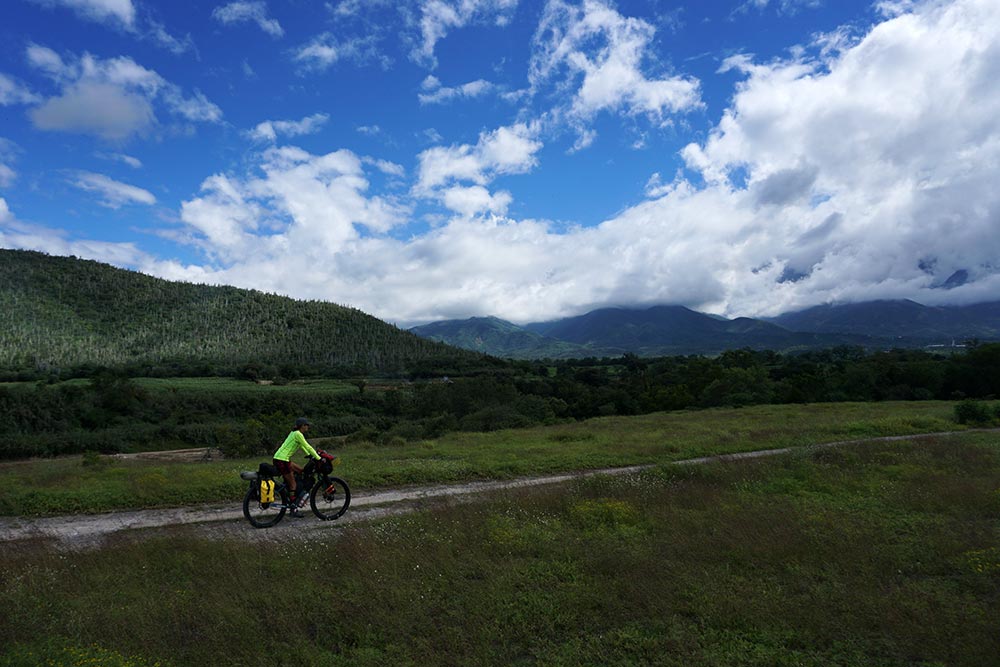
Taking the road less traveled.
We had an epic ride from Tehuacán.
After a long day, as the sun was just dipping below the mountains, we arrived at the spot where Google had indicated a campsite should be found. The buildings we were expecting did indeed show up but the area was deserted and in a bit of disrepair. With little other options, we made our way onto the property and set up camp far from the view of the road. It turned out to be a perfect camping spot for us and only the second time we had set up our tent since leaving Baja. We enjoyed the nighttime sounds of nature as we shared a couple glasses of mescal, toasting a fantastic day of riding.

The first of 4 river crossings.

Very scenic country.

We were all smiles on this day.

Sugarcane!
Surprisingly, our breakfast the following morning was interrupted by a man, seemingly an employee of the facility, arriving to tell us that we weren’t allowed to stay there. As we had every intention to leave when we were done eating, I didn’t put up an argument. I am curious about what the story of that place is.

Making friends with this donkey.

I like how the clouds accent the mountains.

Like riding through a tunnel.

Who needs a GPS?
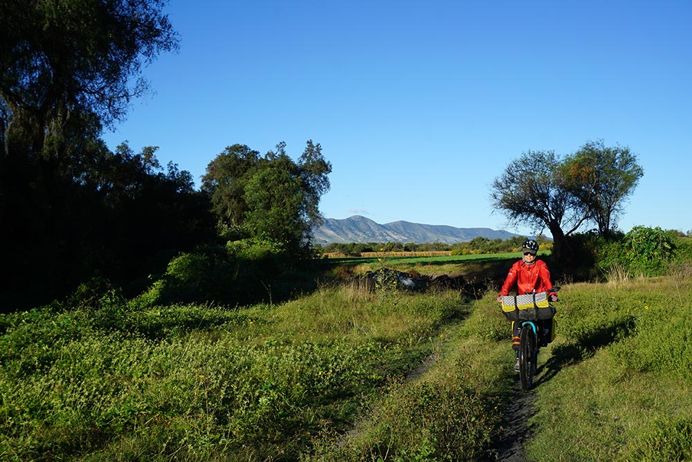
Close to the lowest point of the elevation on our route, we knew that we had nowhere to go but up. Instead of a steady climb though, almost our entire day was spent negotiating a seemingly endless series of rollercoaster hills. Fortunately, the road was incredibly scenic making the effort virtually painless. Given that we crossed over a huge river a number of times that day (or several different rivers, I’m not sure), we were very glad to be traveling on a paved road with bridges instead of trying to cover the same ground on some miscellaneous dirt track which likely would have left us stuck by the water’s edge as we had the day before.
Why not take the bridge across?
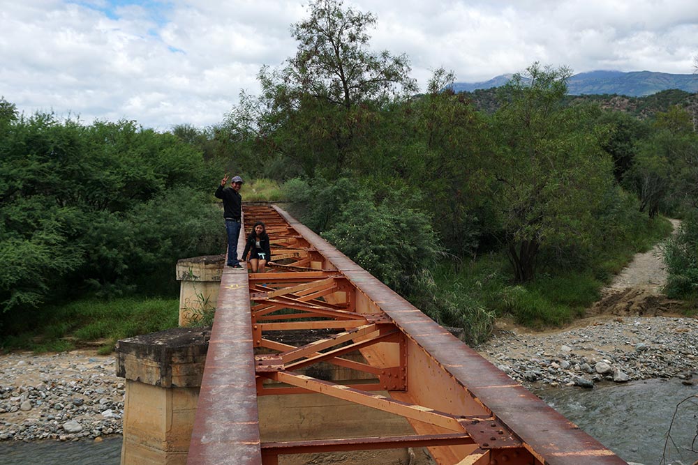
This is why!

Forth river crossing. The water was moving very quickly. We passed a motorcyclist who had turned back, unable to get across the stream.
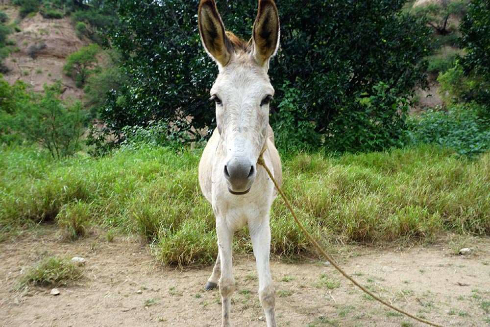
This guy was a bit more skittish than the brown donkey.
After climbing over 3000′ but only gaining a paltry 1000′ in elevation, we started looking for a place to camp. Not surprisingly, with the road steeply climbing on one side of us and falling away into the canyon on the other, flat, secluded areas were in short supply. Ultimately, we did find a spot, hidden behind a locked yellow gate. I’m not sure why the area was cordoned off but after lifting our bikes over the gate and ducking into the brush behind it, we found a perfectly hidden camping spot just off the roadway.

Preparing lunch.
Baja-like terrain.

Morning coffee in our new camping chairs. Love ’em!

Just about to break camp. I wonder what the story of this campground is.
Climbing was the name of the game the following day. Our topo maps indicated that we’d have to climb to 7600′ so we set off slowly winching our way up the hills. First gear, aka Granny Gear, got a lot of use!

Roadside monument. RIP.

Rockfalls like this one made riding too close to the cliffs a sketchy proposition.

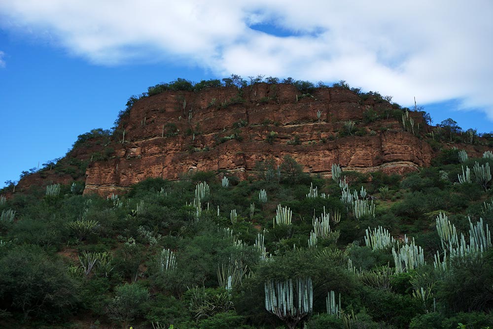
Cacti are once again abundant.
One of the rollercoaster downhills.
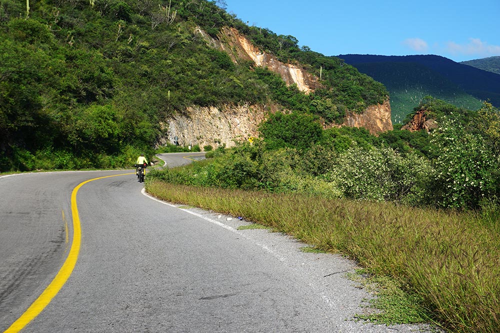
You have a lot of time to think while riding, and especially while climbing. When I wasn’t focused on the amazing scenery around me, very reminiscent of the Espinazo del Diablo, I spent some time thinking about which I dislike more, littering or graffiti. I could do a survey on what borders the roadways more: beer cans, coke bottles, or other drink containers. They are everywhere. I even found a significant pile of trash adjacent to a “Keep our highways clean” sign, a truly sad example of irony. As much as I hate litter, I think graffiti drives me even more crazy. While trash can be cleaned up, it saddens me to see million-year-old rocks defaced by some adolescent professing his love for a boy or girl that likely a few weeks later he/she won’t even be speaking to. Like I said, you have a lot of time to think while riding.

Glad we didn’t have to wade across this!

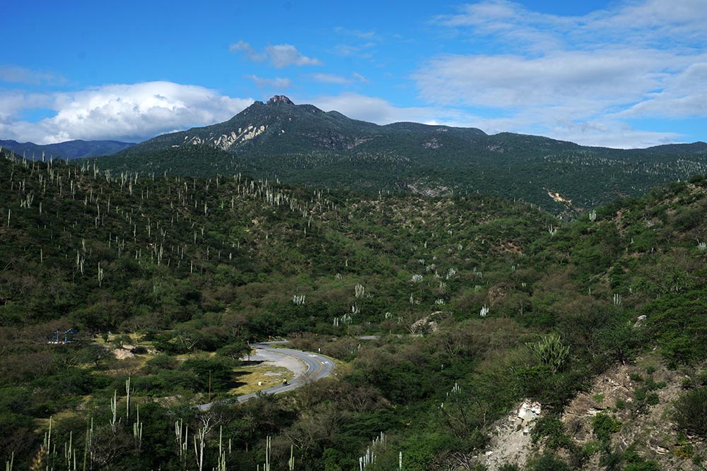
A long, slow, steady climb.

Our second night’s camping location.

We camped in the middle of that area above the road.
Shortly after midday, we reached the highest point in our climb. At almost that exact spot, we came across two older men with a few dogs at their feet, one walking and the other riding a donkey. We called out greetings as we passed but the man on the donkey wasn’t content to leave it at that. He turned around and came back to talk to us, perhaps eager to practice a bit of his very limited English skills, but also to make sure that we knew that we were welcomed in Mexico. That brief exchange was a perfect punctuation mark to highlight our making it over the pass!
Still climbing.

Yes, still!
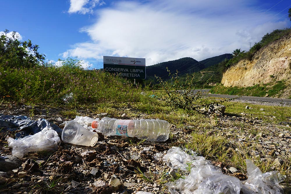
Keep Our Highways Clean!

Almost at the very top!
As you might guess, a steep descent followed the big climb but we stopped not long into it to have some lunch at a smokey (they cook with wood in many of these places) roadside comedor (dining room). We sat there enjoying a couple of awesome quesadillas as a total of nine touring motorcycles rocketed by us. My guess is that it took them no more than an hour or so to cover the ground that had taken us two days. While they may end up traveling many of the same roads that we do, it has to be an entirely different experience.

The Mexican roads have these awesome kilometer markers. Unfortunately, since we seldom know where they are counting to or from, they are of little use to us. In case you follow in our tracks, the top of the climb is at kilometer marker 178.
With bellies full, we wore down our brake pads on the long, steep downhill run, struggling to control our speed. Unfortunately, when we arrived at the area where we had hoped to find a place to sleep, the one and only hotel in the area was no longer open for business. Once again with cell service (we had been without it for the previous couple of days), a Google search indicated that the only hotels were in the city of Oaxaca, still some 20 miles away. Having already had a long and challenging day, we were both ready to call it quits but with little option, we set off towards the city.
Happily, an autohotel did present itself some 20 minutes or so down the road. While a bit more money than we’ve been grown accustomed to paying (a full $30.00 this time), we acquiesced and took the room. It was in the middle of nowhere though, without even a small tienda (store) in the area. Fortunately for us, Rebecca had some food hidden away in her panniers so that she could make us dinner.

Morning mist.

First stream of the day. We ultimately road across this one.
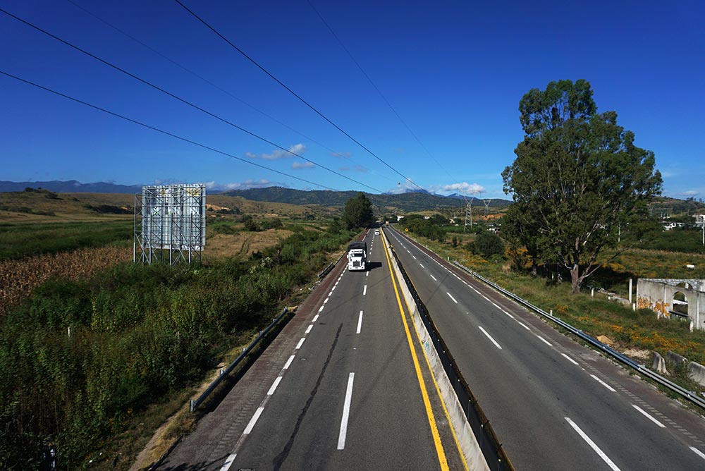
Passing over the toll highway. This was our other option for riding.
We knew that our host in Oaxaca City, then only 20 miles away, was going to be occupied the following day so with no real urgency to get there, we set off on the back roads, slowly making our way towards the city. We covered a good 14 miles before finding a spot for breakfast. While riding that distance, we had to cross over 5 streams (two with bridges – Yeah!), traveled through 8 villages, and passed more than a dozen horse or donkey driven carts. In other words, it was an awesome ride.

What happened to the bridge?

Feet wet but still all smiles.
The Zocalo, the main town square, was our initial destination in the city, hoping to find a spot to rest and people watch until our host, Alex, was available. Neither of us typically pay too much attention to what day of the week it is. It was only when we arrived at the town square and found it full of people did we give some thought to the date, coming to grips with the fact that it was Saturday. With hundreds of people out and about, the Zocalo was full of the sights and sounds of the vibrant city. In my mind, it was a perfect end to an amazing 6 days of travel.
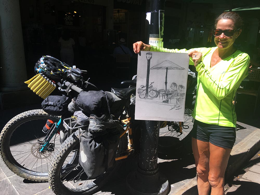
As we sat in the Zocalo enjoying a coffee, a sketch artist did this quick, unsolicited pic of us.


Great post! Such a cool experience…it makes me want to get out and ride. Your experience with the friendly people of Mexico is much as mine has been visiting there over the years. I am always stunned when people tell me how “dangerous” Mexico is, and how I would be crazy to ride a motorcycle there.
I hate both graffiti and trash….though graffiti is harder to remove. Where we live in the South, people flick cigarette butts out of their cars all the time, as if it was not litter. I always want to jump out, pick up the butt, and flick it back into their car.
No kidding. That would drive me bananas too. Actually, any kind of littering does.