Not EFI
There’s an expression used by some cycling tourers, shortened down to EFI. EFI stands for Every F^#%ing Inch. I had hoped that some day Rebecca and I would be able to boast that we rode EFI of the Baja Divide but yesterday, after becoming increasingly frustrated by an unrideable section, we created our own detour to the highway, and rode the last 10 miles into Cataviña on asphalt.
We’ve covered a lot of miles since our last update, riding from Vicente Guerrero to the coastal town of Neuva Odisea, then up into the mountains, through a picturesque desert, ultimately ending up in Cataviña, where we are now. We had a good rest in Vicente Guerrero, and left there with well-tuned bikes and fresh legs. We were feeling strong, and the trails departing the town, described as mellow on the Baja Divide website, were enjoyable to ride, even though we did start the day off riding in thick fog. We were making such good headway that we decided to push on past our planned stopping point, riding all the way to the coast. We had our first taste of riding on the beach, dodging waves from the incoming tide, and being aided along by a blistering tailwind. We found a place to pitch our tent at an all-but-deserted campground, and had a restful night’s sleep to the sound of waves crashing on the shore not far from our heads. Unfortunately, the next day would not be so pleasant.
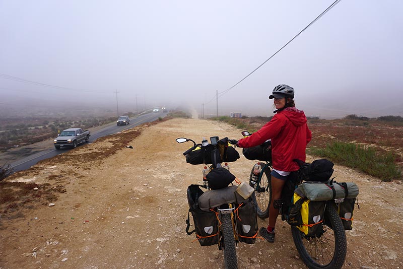
We were glad to have this massive dirt shoulder to ride on, especially given the foggy conditions.

Salavdor at FASS Bikes let us know that the first portion of the route leaving Vincente Guerrero had been closed. We followed his suggestion to ride along the highway for a bit before heading inland to pick up the trail again.
Mellow trails!

Nopales.

Some red weed. Not sure what it is, but it looks pretty.
To Molino Viejo.

A popular tourist destination, perfect for our mid-day break.

Our first margaritas since arriving in Mexico!

Less likely to run into this guy in the desert.

Our new bottle cages carrying 1.5l bottles. Although we had hoped to be able to refill them, we’ve come to find out the hard way that the plastic they are using these days is much too thin.

One final pic before riding on.
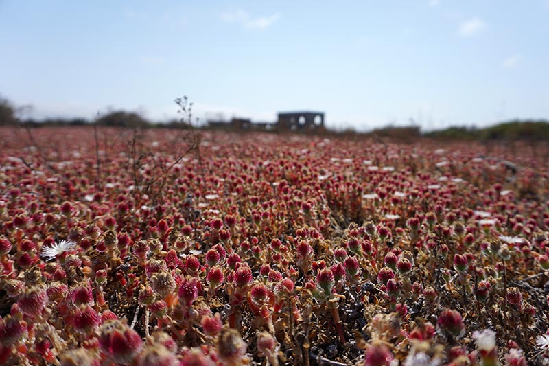
More red weed.

And red flowers.
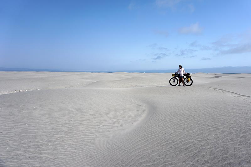
Now this is a beach!

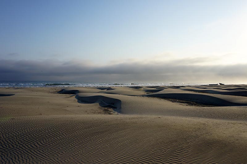
Fat tire tracks and sand dollars.
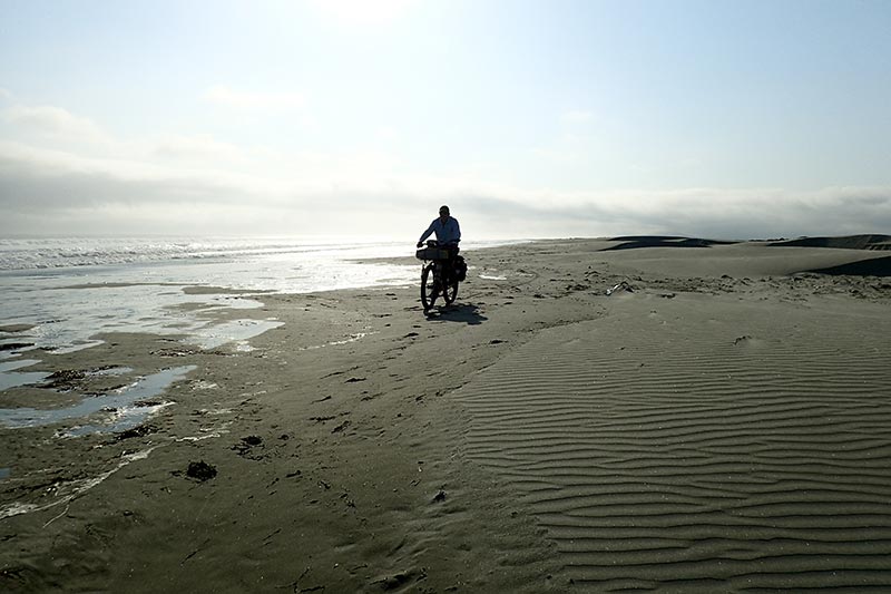
The beach riding was not as easy as we had hoped.
We did not go swimming in the Pacific this time around. The waves were big!

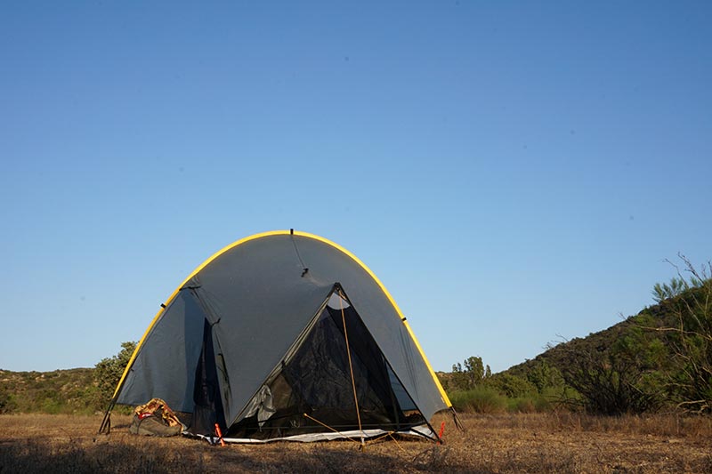
How’s this for a camping site?
Beginning at sea level, we knew that the next leg of the route was going to involve some climbing. Our topo maps showed that we had to climb to almost 2600′. What we didn’t grasp is that the trails would be all but unrideable. In fairness, maybe they are rideable by some people, or by those with motorized vehicles, but on a bike, they were not for us. Compounding the problem is that our bikes were heavily laden with water, knowing that the next re-supply point was 58.3 miles away. I wish I had an easy way to say how much we pushed the bikes instead of riding them, but I don’t think I’m exaggerating to suggest that it was at least 50%. For the record, riding bikes is fun. Pushing them? Not so much.

After climbing a thousand or so feet.

Yes, we came from way back there.
Yeah, way over there someplace.

The first of many large cacti that we would see.
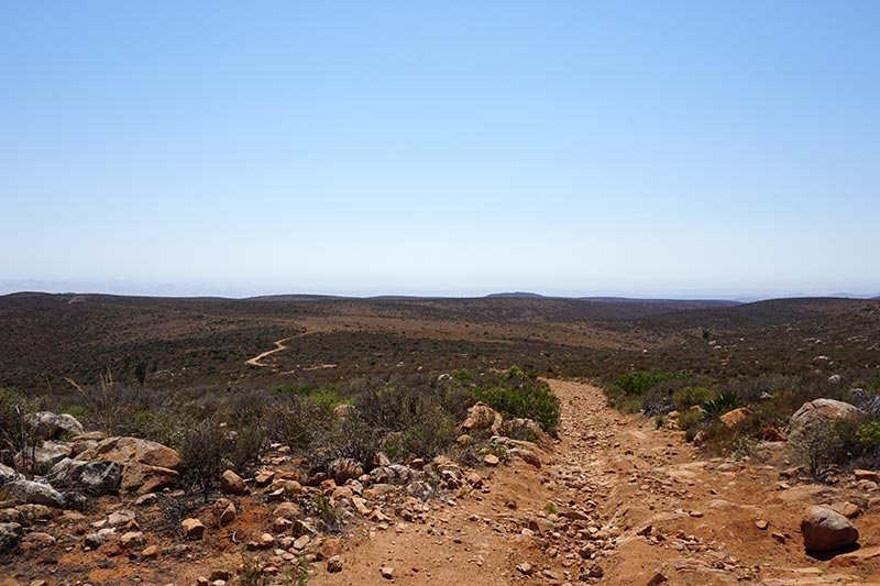
Not a good bike riding trail!

Perhaps you can ride this, but not us!
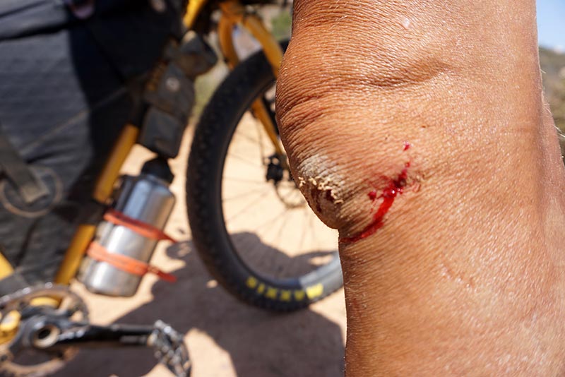
First real battle wound, obtained while pushing the bike, not riding it! That’s how rough the trail was!

All doctored up.
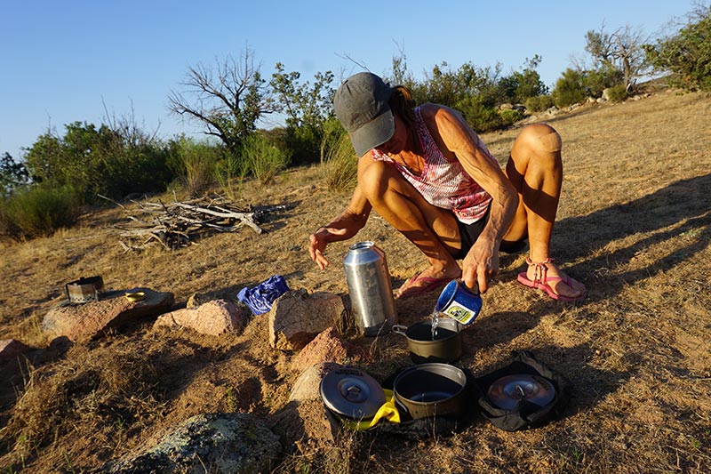
Dinner time.
While Rebecca was preparing dinner, I was playing with the camera.

Our first camp fire in Mexico!
After covering only 20 miles of the 58, we set up camp, hoping (praying!) that the downhill leg would be easier. If there’s one thing that we’ve learned thus far, nothing is easy on this route!
Much like the uphill stretch, the trail heading steeply downward from the top was covered in rocks ranging from fist to coconut sized. So, while we did not have to pedal, even going downhill was technical and tiring. When we did come across flat stretches, they were often covered in sand, another obstacle to smooth pedaling. If you’re getting the picture that we didn’t like this leg of the trip very much, you’re right.
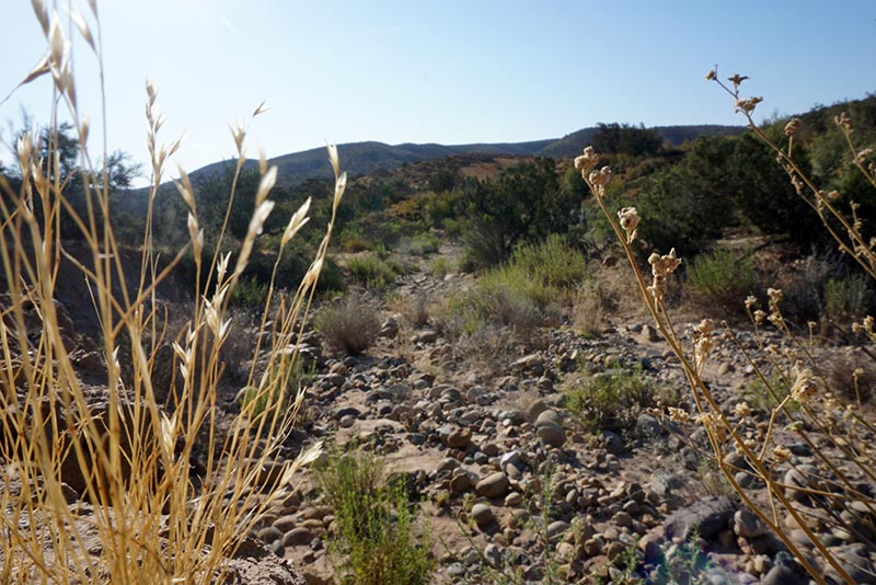
At some point during the year, this would be a stream. Now it just looks like the trails!

Before the day got too hot.

The terrain changes from day to day, and even hour to hour.

Love the colors!

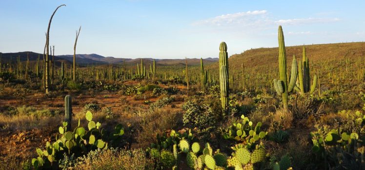
One of thousands of huge cacti that we would soon see.
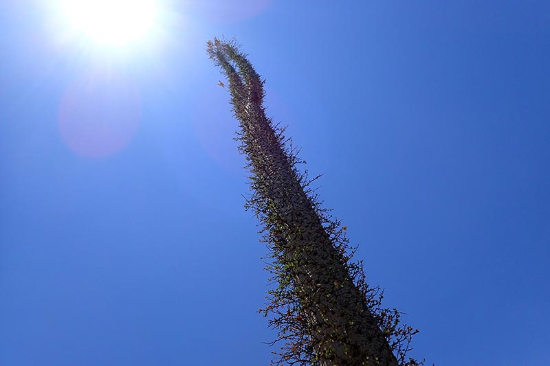
These look like they should be in a Dr. Suess book.

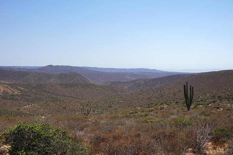
What we picture when we imagine a real desert!
Fortunately we were not sacrificed to the desert.

Keeping watch high above the action.
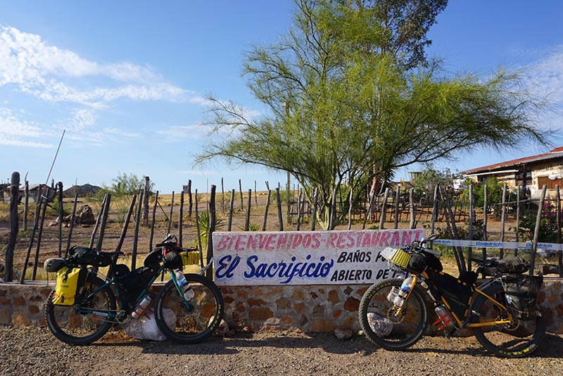
Sometimes the scenery makes up for the suffering. In this case, it didn’t. At least, not until we had descended into the valley where tall cacti grew as far as the eye could see. That was spectacular, and would have been a great place to camp, but unfortunately, we were on a schedule, one defined by water. We had enough water to last us the day, but we were somewhat committed to riding the entire 40 miles to the El Sacrificio roadhouse, and 40 miles is a big day for us!
We made it to El Sacrificio at around 5:00 PM, and upon doing so, stuffed ourselves with enchiladas, and rehydrated with cold drinks. Even though our re-supply list didn’t suggest that we could camp there, the owners welcomed us to their property. And that’s a good thing, because riding any further that day was the last thing I wanted to do. If you decide to follow in our tracks, be aware that the rooster at El Sacrificio does not know the difference between the middle of the night, and dawn. That’s OK though becuase their rustic showers made up for it!
Leaving El Sacrificio at 6:00 AM, we rode down the highway a few miles so that we could restock out water supply at El Descancso. We had another very long stretch to cover before reaching civilization – a relative term, I should point out – and needed to have all of our containers full again. Our resupply list indicated that there was a concrete well on the route just 8.4 miles from El Descanso. Fortunately, we didn’t opt to rely upon it, because when we arrived, we found it dry as a bone. I should also point out that we passed multiple dry stream beds the day before, ones that had been reported by others to be a source of water. That’s what we get for riding this route in the summer!

The beginning of another descent.

A source of water?

Negative. Dry as a bone.

Yes, we carry cards, but they are tiny!

Still smiling. Kinda.
The course continuing on from there was a mix of riding. Even though much of the trail was again covered by fist-sized rocks, we were able to pedal over some of it, albeit at a snails pace. When we finally camped for the night, after another full day in the saddle, we did so with enough energy remaining after dinner to entertain ourselves with a game of cards. At one point in the evening, I broke out the calculator on my iPhone and somehow calculated that we only had 20 miles to ride the next day to get to Cataviña. Woo hoo… a short day. I’m not sure exactly how I screwed up so badly, but I was far from correct. The actual distance, which we only figured out the next day after riding the first 8 miles, was closer to 35 miles. A distance which is in no way short for us!

Always awake before the sunrise!

Love these big jack rabbits!
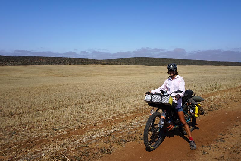
The first bit of riding from our campsite was pleasant, along farmers’ dirt tracks, with jack rabbits racing back and forth in front of us. That pleasant riding was soon to end though, just about the time we figured out my math error. We found ourselves on a trail paralleling the highway that was once again, covered entirely with large rocks. Riding over this, when we were not forced to dismount and push the bike, was not fun. In any way. Nor, do I imagine, is it good for the bike and tires. Even though it was still early in the day, my shirt was near transparent from sweat. Rebecca and I, neither of us happy, were also both starting to snap at one another, something that hardly ever occurs. Coming to grips with the fact that we were not enjoying ourselves, and having a potential bailout point so close to us – the highway – we took the next “road” heading off to the right, and started making our way towards MEX1. The fact that our road, which was not an actual road at all, was much more rideable than the track that we were supposed to be following, should tell you something. My bike was probably in shock at having me switch into a gear higher than five!

Our short cut to the highway. Yes, we cheated.
While traveling on a highway is never fun, especially given that, in this case, there was zero shoulder for us to distance ourselves from the traffic, I made the best of the ride while working our way towards Cataviña. For the most part, the traffic was light, and the drivers, especially the commercial ones, were respectful of us, often moving into the opposite lane when passing. In time, the landscape changed from ugly scrub to magnificent boulders, giving us something to focus on other than the heat and the traffic. The rocks reminded us both of Virgin Gorda’s Baths, but without the water.
After 10 or so miles of highway riding, our first stop in Cataviña was a place called Cocos. While we thought that it was a restaurant when we pulled in, and it still may be, I’m not sure, the gentleman working there, David, told us all that he had to offer was coconut water. Being as hot and dehydrated as we were, that sounded great to us, and so we ordered a couple. Instead of just a cold beverage though, what came after we downed the chilled liquid was a masterpiece. David chopped up the coconut meat, and served it to us with spices, hot sauce, and Clamato juice. I don’t know if David realizes just how much he did to salvage my mood on that day. Before leaving here, we’re definitely going to have to go back to see him again for another helping.

Zero shoulder to ride on.

There were several cool hills like this around.
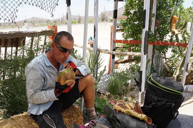
Cool coconut water… heaven!

Gourmet!
Trip Stats:
- Vicente Guerrero to Neuva Odisea (camping): 71.39 km
- Neuva Odisea to Wild Camping: 32.93 km
- Wild Camping to El Sacrificio: 63.98 km
- El Sacrificio to Wild Camping: 53.52 km
- Wild Camping to Cataviña: 44.93 km

I really like your honest writing style. Adventures have there highs and lows and with experience become easier. Who cares about some of what you call cheats. I call them wise choices. Those trails or lack of trails looked impossible. Love the pictures.
Thanks, Lisa. I hate when reviews make things sounds perfect, especially when we go on to find out that the glowing report is far from true.
Fabulous photos of amazing countryside, but it is obvious that you are working for every inch that you travel. More power to you and great to see that there are still smiles on your faces (at least on most of them). Those “trails” definitely do not look like trails to me – think you were definitely smart to make your own adjustments to the route. Just like in sailing you can have a plan, but other forces can change them – flexibility is the name of the game. No harm in that at all – being smart out wins every time in my book!
Thanks, Janice. Plans can and often do change upon contact!
Captivating stories and pics; thanks very much for sharing. Your big tire bikes inspired us to buy a couple ourselves… foldable fat tired ones that have a 40 kilometre range on the Pedal Assist batteries :). Don’t think we’ll be taking them on any of the ‘roads’ I’ve seen you adventurers on so far! Stay safe and thanks for keeping us posted!
We both just tried out an eBike at FASS bikes. Awesome. I could have a lot of fun on one of those.
This is awesome!!! I love your photos, what a beautiful, interesting and harsh landscape, those views are so hard earned! I also like your honesty about the suffering, it looks so challenging. You guys are rad, I love reading about this 2 wheel adventure even more than the sailing!! How hot is it at midday riding along the highway? Are you gonna keep riding all the way down to Patagonia?!
Hi Julia
Thank you! How hot is it? Great question. Well over a hundred F, I’d guess, but I don’t know for sure becuase I didn’t spent the 10 bucks on the little thermometer keychain at REI. 🙂
Our goal has recently been to find a shady spot to sit out the warmest part of the day, but shade has been almost non-existent. As for Patagonia, yes, that is still the goal. Rebecca and I were discussing that only just yesterday.
Beautiful pictures but looks like a really tough ride. Wow. I have to get down there, but on a motorcycle.
Make it a dirt bike!
I have no idea how you are doing this. I’d die.
It’s tough, that’s for sure.