We made it to La Paz, but are not done yet!
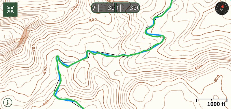
I don’t recall where or when I first learned about topographic maps, their squiggly little lines used to turn a flat piece of paper into a 3D representation of the earth. It’s not the kind of thing that the majority of people have a use for. After all, except in extreme situations, your car or truck doesn’t really care if there’s a little uphill or downhill. Cycling is a different matter though. Trying to read these maps, and then extrapolate their data into what it will mean for our legs and our lungs has become a routine thing for us. Unfortunately, a 2″ x 4″ iPhone screen is not the best medium for displaying them.
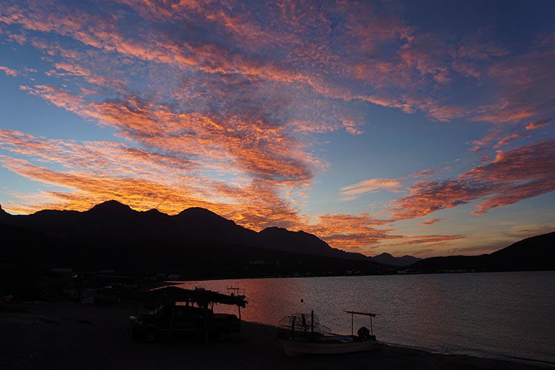
Final sunset in San Evaristo.
See that hill in the distance? Yeah, we’ve been there, done that.
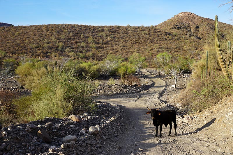
The guardian of the road.
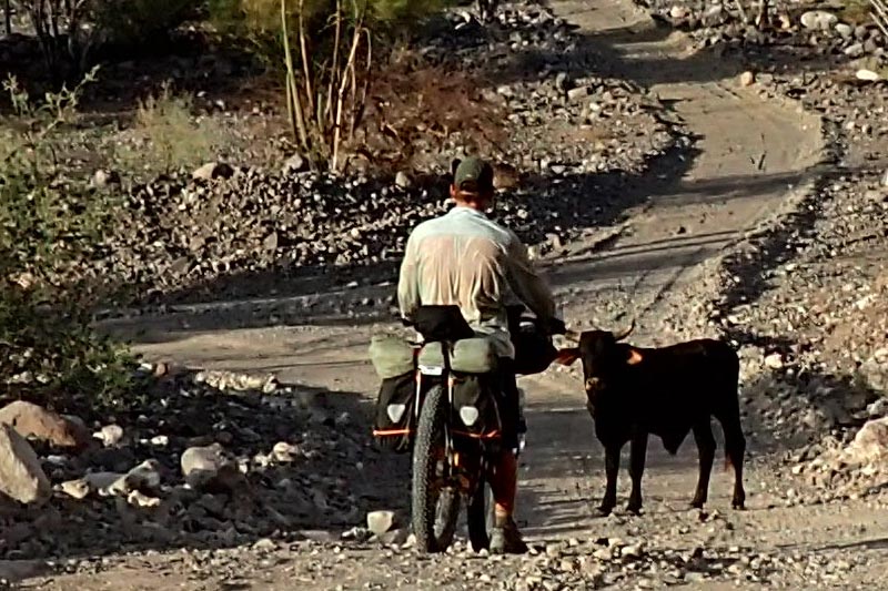
All animals respond favorably to the kissing sound.
Take the up, down, up, down situation that I described early on in my last post. If the change in elevation is less than a hundred feet, it doesn’t really show up on our map. While perhaps not significant enough for the cartographer, those hills can be significant to us, especially when repeated over and over!
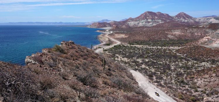
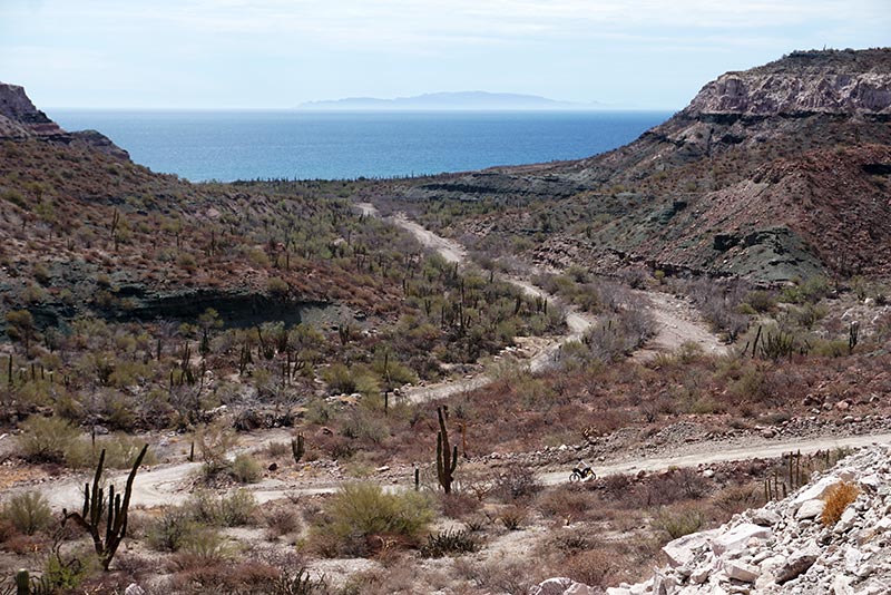
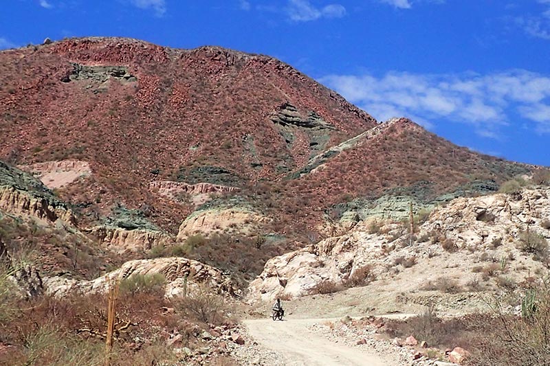
When looking over our route from San Evaristo to La Paz, we noted that it was mostly flat (we now never assume that flat means easy) with one exception, a climb to just under 800′ not long out of San Evaristo. No problem right? We’ve climbed much higher before.
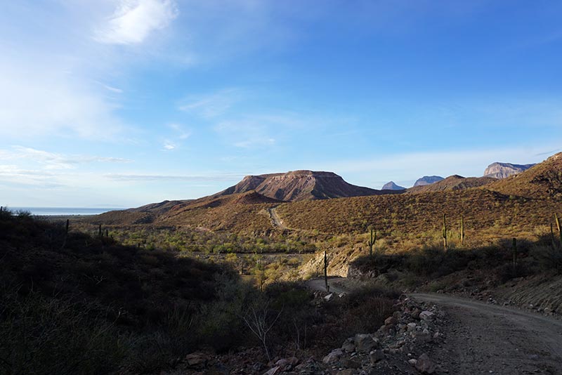
THE hill.
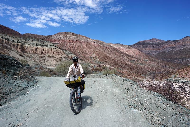
The trick when reading the topo maps is to note how closely spaced the lines are. When very close together, that means the hill is going to be steep. In this case, the majority of the climbing took place in less than a mile, making it very steep! So steep in fact that we had difficulty even pushing our heavy bikes up the sometimes-slippery hill, let alone riding them. The steepest section was actually paved which only ever happens when the angle is so great that the trucks have difficulty negotiating the hill.
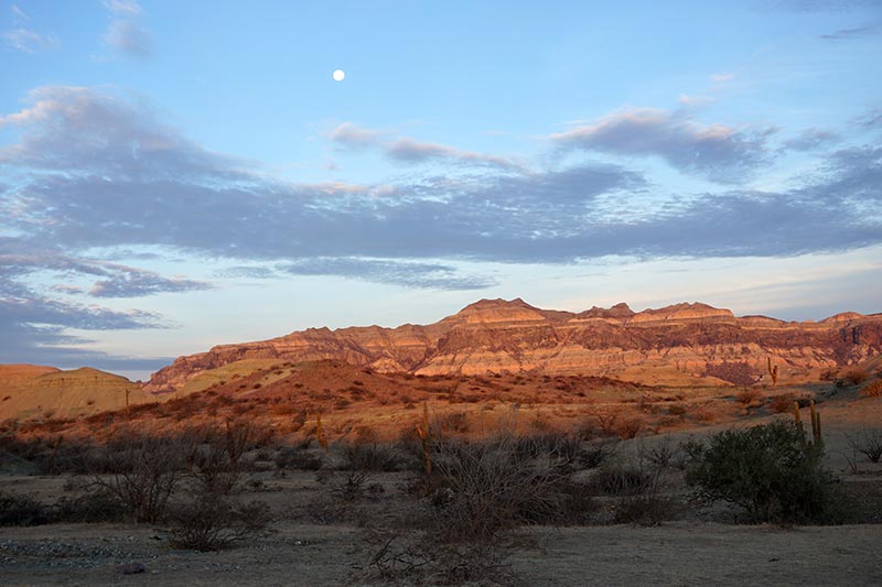
The hills are beautifully lit up by the early morning sun.

The kissing sound works again!

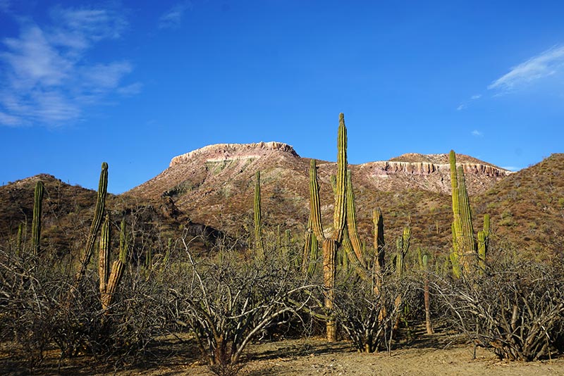
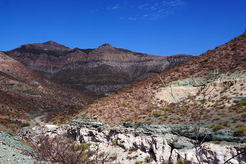
It continually amazes me how mountainous Baja California is.
Of course, we made it, and with that hurdle behind us, we carried on south. Our initial goal was to get to Punta Coyote by lunchtime. It was reported that there was a snack stand there where hopefully we could buy a cold drink. If you’ve been following along you probably can guess where this is going: there was no snack stand. In fact, there was nothing there, save for a big, shady tree. The shade was so good that we made it our home for the next few hours, and even put up with the ants which also called that area home.

Sea of Cortez is not far off.

“You’ve got to be kidding.” – Us, to each other.

Heading down the other side.
At 4:00 PM we pushed on. The route was, as we had guessed, flat, but that meant that those using the road could drive it at speed, creating the inevitable washboarding that I love (/sarcasm) so much. Even though the hottest part of the day was behind us, it was still scorching, so we took refuge under a roadside tree to have dinner, and wait until the sun actually set. When I say road side, I mean that literally: we were sitting on the road. No doubt due to our closer proximity to civilization, drivers no longer stop to ask us what we’re doing when they pass. Most don’t even slow down anymore. They instead scream by us, coating us with dust.

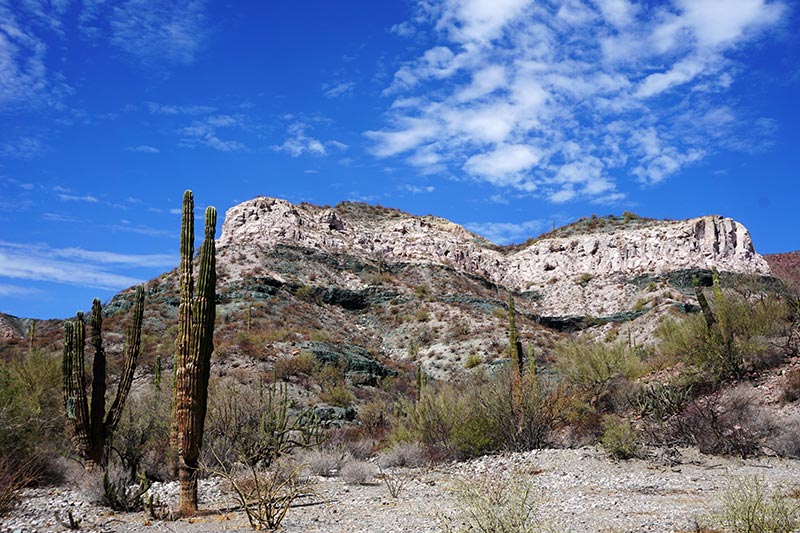
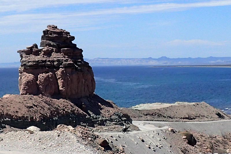
The rock formations in this area are stunning.
Enjoying the descent.
Looking back towards where we came from.
When we saw an approaching pickup truck heading straight for us, honking its horn, we expected it to be just another thoughtless driver. Imagine how pleased we were to find that the truck was filled with our new friends from San Evaristo: Lupe Sierra and Maggi Mae? They were on their way to La Paz to purchase supplies for the restaurant (did we eat and drink too much?), and not only stopped to chat for a bit, but also presented me with an ice cold beer. Angels from heaven!

Heading back down to sea level.
It’s a lot faster going down than riding up.
So colorful!
With no more sun to melt us, and the temperature having dropped to a tolerable level, we climbed back on the bikes and continued riding south. Although we were paralleling the coast, we were still quite a distance from the water, something that we could tell from our maps would change in approximately 20 km. Our goal was to get to the beach to camp, and we even went so far as to do some riding in the dark, using our headlamps to illuminate the ruts in the road. Ultimately, we came to the conclusion that continuing on in the dark was foolish, not knowing what type, if any camping spot we’d find when we actually got to the beach. We instead opted to pull off the side of the road and camp at the next suitable patch of flat ground.
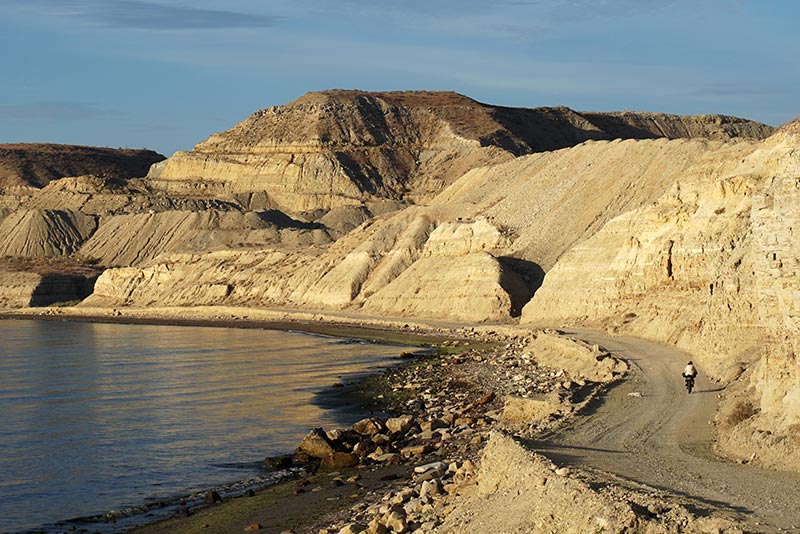
A layer cake.

Heading down once again.
With the thought that we might reach La Paz in one day instead of the two that we had initially planned for, the next day we set off immediately after waking. When we arrived at the sea that we had been looking for the previous night, we had a quick breakfast – sans coffee – and then rode the last bit to San Jose de la Costa, a town our resupply chart noted with a capital F (lower case f indicates small food stand, capital F indicates a more reliable source of food). When we pedaled into the town though, an old woman at the first and only sign of a store indicated that they didn’t even have cold drinks, let alone food! She did say that there was another store nearby, and pointed off in the distance somewhere. In this case, in the distance equalled up a big hill, but by this point we needed to resupply our water, so went exploring to see if we could find this other store. Sure enough, one did exist, and it was busy enough servicing the residents and workers from the nearby mine. It was a bit off route though, making us a tad nervous until we actually located it.

It’s difficult to keep our focus on the road.
As seen from the top.
Rehydrated, both with water, PowerAde, and frozen sugar water (popsicles), we set off towards La Paz again. Once more the hills that didn’t show up as significant on our topo maps came to bite us in the butt. Up and down we went for quite some time, skirting the coastline on some high cliffs. The only thing making the climbing easier to take was that the road was nicely paved, and had little traffic.
Breaking camp in the morning. We picked this spot in the dark.

Our shadows are riding with us again.

“Was that you making the kissing sound?”

The horse has a loud bell around its neck.
The miles clicked by quickly enough, and just about 5:00 PM we rolled into the downtown area of La Paz, navigating our way to the Hotel (Pension) California, a spot made mention of in the route guide. Apparently the hostel is a favorite of backpacker types, and that includes bikers, both pedal powered like us, and those using gasoline for fuel. The place had an interesting vibe so we secured ourselves a room for the night, got cleaned up, and set off to explore the area.
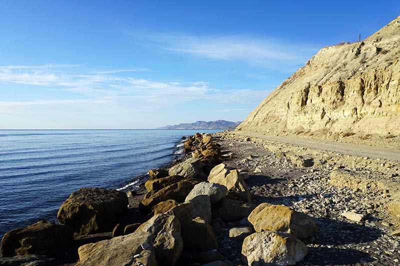
Sea level.

How’s this for a breakfast spot?
We’ll be heading that way.
The Baja Divide guide shows that we have now completed 83% of the route. We had questioned whether we would continue riding here in Baja, or simply head to the mainland to continue our way south. We’ve decided that we will stay here and continue to follow the route out of La Paz, although we may still deviate to ride some of the coast line. There are a few things we want to accomplish before we leave here though. Not the least of which is having our bikes babied a bit by one of the local bike shops. We’ve already stripped most of the bags off the bikes and will be dropping them off to the shop later today. After all the hard work that they’ve put in over the past 2 months, they deserve a spa treatment. Wouldn’t you agree?

A busy-looking mining operation.
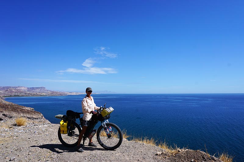
On top of one of those hills that didn’t show up on the topo maps.

Smooth pavement and little traffic.

We made it!

Note Walmart sign! 🙂
Trip Stats:
- San Evaristo to Wild Camping: 59 km, 13:06 hours
- Wild Camping to La Paz: 72.8 km, 9:34 hours

Congratulations!
Gracias!
If looking for bike work I would recommend Ressel Bikes in La Paz (note, new location just a couple blocks from Hotel Pension California) or The Bike Hub in La Ventana. I think you would enjoy a day in La Ventana to hang at the beach and maybe ride some of the singletrack trails in the area. The Bike Hub is a new shop associated with a large eco-tourism ranch called Rancho Cacachilas. They have a very modern and well stocked little shop, one of the best in Baja. Their mechanics are also very skilled and they speak English.
I’ve enjoyed following along, enjoy the last part of your ride!
Thanks, Nicholas! Our bikes are at Russel Bikes right now getting the spa treatment. La Ventana was recommended by one of our other friends too. Who knows… maybe we’ll head that way. 🙂
One thing that I have noticed in all of the great pictures from this post is there are an amazing assortment of colours. From reds to greens and towards the ends yellows. And I can imagine that the photos don’t do it justice as it would in real life. You’ve come a long way guys! Congrats.
You’re right, the pics never do justice to the true scene. I’d love to see the colors during the winter months.