The most challenging could also be the most epic
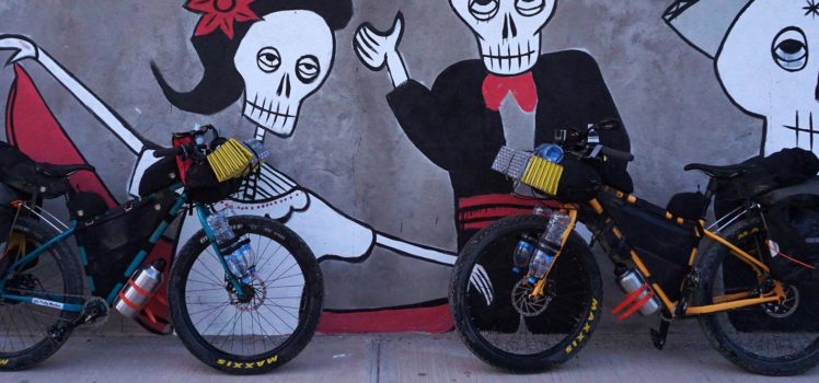
It may be hard to imagine that the leg described as “the most challenging ride on the Baja Divide“ would become our favorite, and I say that because it’s surprising to me, but that’s actually how we’d describe the route to Mulege. In spite of the two and a half day journey from San Juanico being extremely strenuous, everything about it was epic. There are a number of reasons why we enjoyed it so much, and none of them are because we’re masochists.
Warning: The ride from La Ballena to San Miguel is very strenuous. – Baja Divide route notes
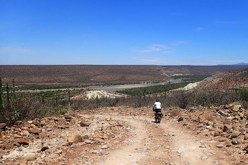
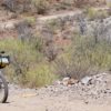
Heading back to the Baja Divide from San Juanico, Cadeje in the distance.
Another oasis?
In my last Baja Divide update, I wrote that we were hoping to secure a ride from San Juanico back to the La Ballena turn off so that we could rejoin the route. Although it was only 24km to return to that spot, we knew that it was going to be entirely on a washboard roller coaster, something that neither of us were looking forward to. In fact, we are so adverse to washboard roads that we were looking for just about any way to get away from having to ride that entire distance, even if it meant climbing a mountain to do so.

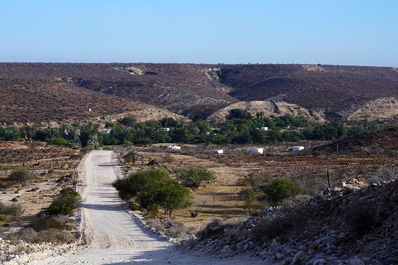
Cadeje is a very pretty town.
Google Maps is awesome!
During our first meal in San Juanico, we struck up a conversation with some motorcyclists who had ridden from Mulege on their dirt bikes. When I told them that we’d be following in their trail to Mulege, a la Sierra, they mentioned in passing that it was possible to get there from Cadeje too. Cadeje is one of the towns that we passed through on the way to San Juanico, and one that we’d need to ride back through again on our return trip. It was also 10km short of La Ballena, which meant that, if what the motorcyclist was saying was true, we would have 10km less of washboarded road to ride. This was worth exploring!
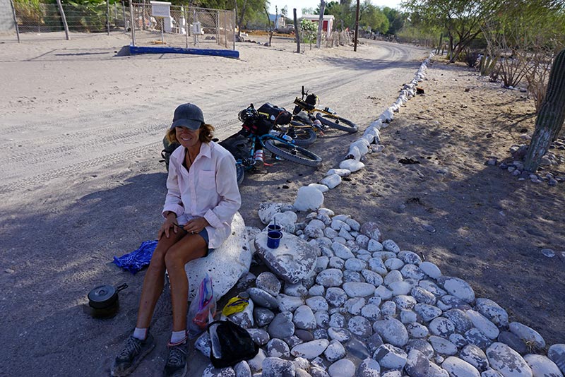
Breakfast, with coffee, on the side of the road in Cadeje.
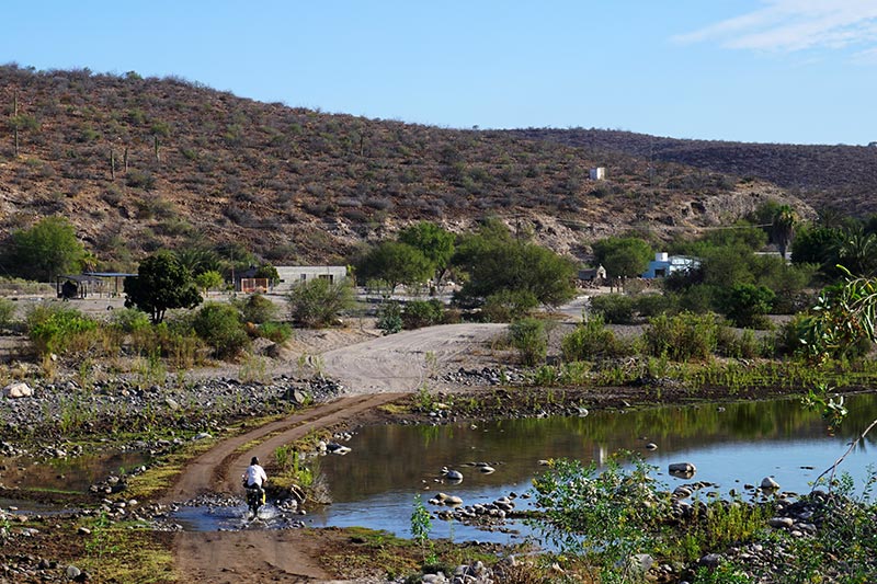
Looking back towards Cadeje, first “river” crossing.
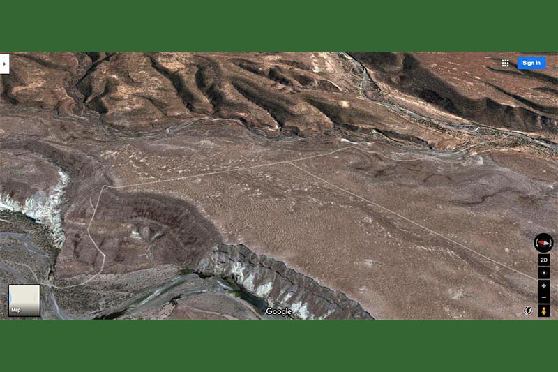
Rebecca and I consulted our paper map and although it showed a road leading away from Cadeje, it did not join up with the Baja Divide route, something that we definitely wanted to do. In fact, the road on the map just stopped. Google Maps, on the other hand, in satellite mode, showed us a couple of promising options. Of course, there was the problem of a pesky mountain in between Cadeje and the route that we were hoping to rejoin, but as I said, if it would help us to avoid having our teeth shaken loose on the gravel road, we were up for blazing a new trail.

Rock – Sand
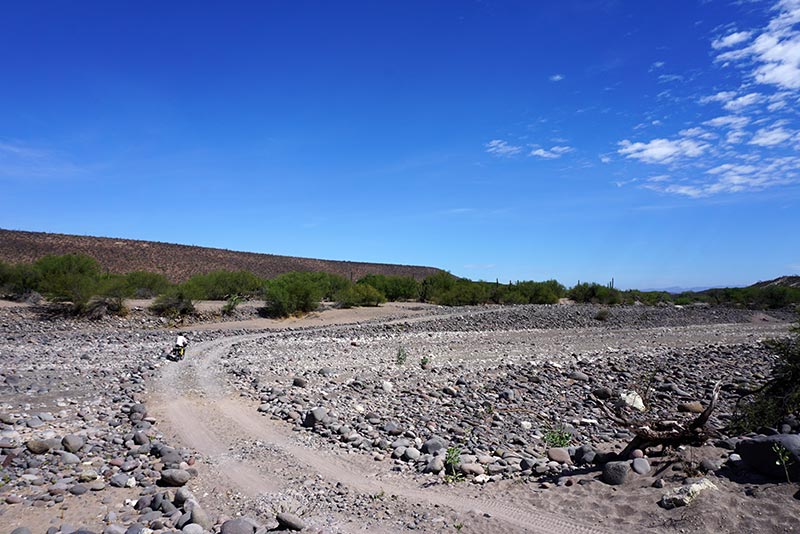
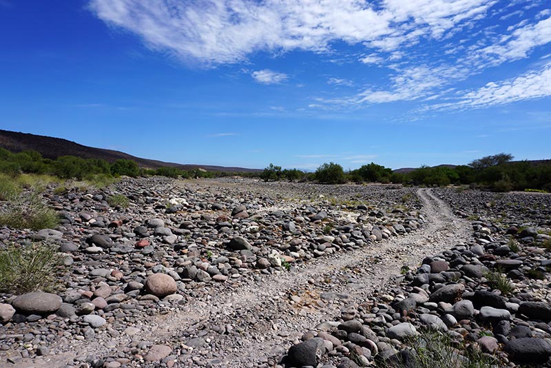
We counted river crossings for a while.
We left San Juanico just before sunrise with the thought that, if someone with a pickup truck passed us, and we could entice him/her into giving us a ride to La Ballena, we’d take that, and complete the route proper. If, however, no one passed us, we’d turn off at Cadeje and take our chances. As it turns out, not a single vehicle passed us, let alone a pickup truck willing to pick up two hitchhikers and their bikes.

Shocks would be nice.
We ultimately lost count of how many times we crossed the river.
We stopped in Cadeje to have our breakfast on the side of the road, with the intent that we’d question one of the local residents about the sanity of our plan. The two young men that I ultimately did approach were very helpful. One even began drawing a map in the sand. We had in mind two different options. The first road we mentioned, only a mile and half from where we were standing, he described as malo, meaning bad. The second, just beyond a ranch named La Yaqui, was the one he seemed more focused on, and also one that we believed would work too.
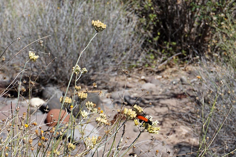
Tarantula Hawk. Avoid these guys!

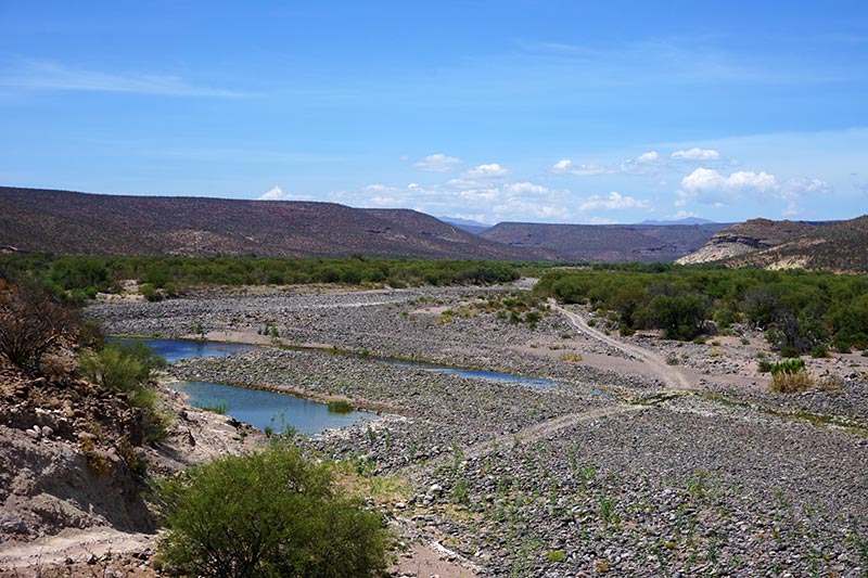
Imagine all this covered by water.
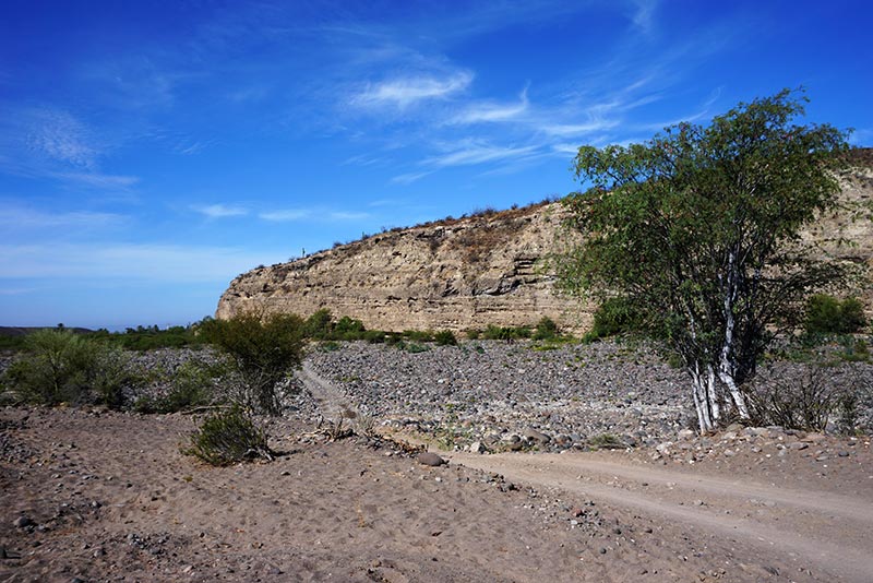
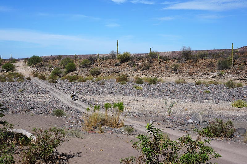
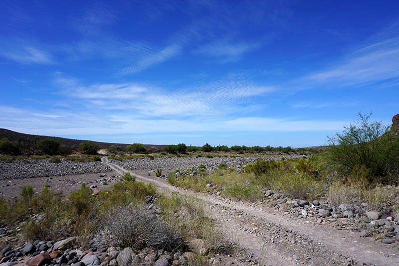
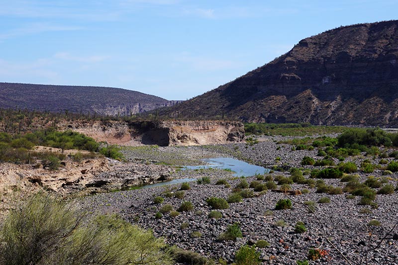
With that added bit of confirmation, we set off east of Cadeje, our GPS tucked away in our bag as we were no longer following the blue line. Our helpful friend described that we’d cross the river a number of times. He actually drew the crossings in the gravel as he made his map. It’s a good thing he eventually stopped drawing because we crossed the river almost a dozen times before reaching the point where we’d have to do some climbing to get to where we wanted to go. Of course, being summertime, most of the river crossings were dry, but the width of the areas where water at one time must have flowed was awe inspiring.
We took pics to keep track of how many times we crossed areas like this.

The first bit of real water we saw since Cadeje. Not too appealing.
We had little doubt that a road existed that would lead us east from Cadeje. We only had a tiny bit of doubt that there was a road that would lead us up the mountain, north, towards the area where the Baja Divide track was located. Of course, we had no perspective of how high the road would be, or what kind of condition it would be in, but how hard could it be, right? Our biggest questions were how difficult would the descent on the other side be, and would we easily be able to reconnect with the route?
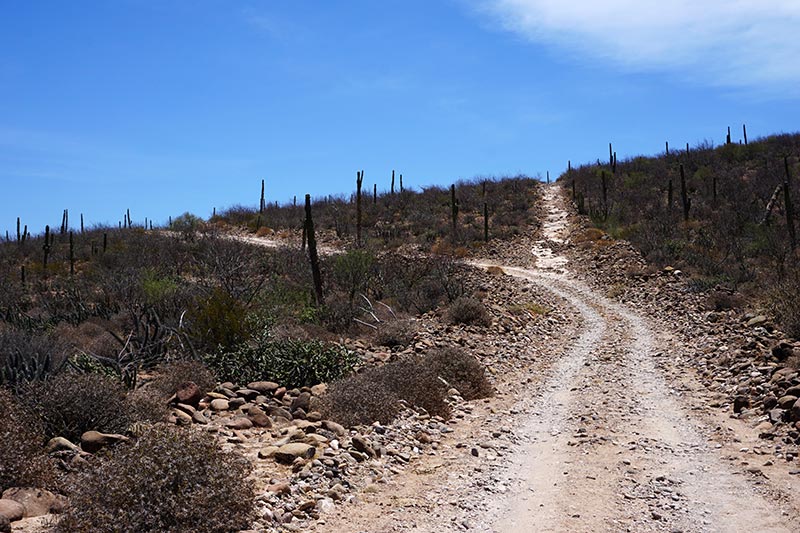
Much of the route was like this, or worse!

And the road goes on forever.
The worst case scenario would be that it was not possible, and we were fully prepared to turn around and retrace our steps should it become necessary. As luck would have it, our plan not only worked, it worked out perfectly. Not only were we able to avoid 10km of crappy, washboard gravel road, we were able to shave 10 or more kilometers off the total distance to ride. Of course, the price for that was a bit of climbing, which in this case was actually pushing the bikes up the long, steep hill, but it was entirely worth it!

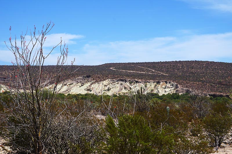
The hill we need to climb to get back to the Divide route.

From the top, looking back.
After rejoining the Baja Divide route, we pedaled on for another 11km before calling it quits for the day. Some of you may remember the post where I described my criteria for the perfect camping spot. Well, we found it, and yes, it included water to swim in! The bar has been officially set when it comes to camping spots, and I’m not sure when, or even if, we’ll be able to top this one. Suffice to say that even though we could have pedaled another hour or two that day, there was no way we were willing to pass this place up.
On top of the plateau the road was pretty good.

And the descent. We need to get way over there.
This is a lot more steep than it looks.
Funny thing about satellite imagery: I thought this watershed was a road! Look at the screen capture above and tell me what you think.
Another image of the road/watershed.
We took a lazy start the next day, having breakfast before pushing on. As the trail notes indicated, and as we experienced the day before, the riding on this section of the trail was tough. While there were some stretches of relatively smooth riding, there were even more sections of large rocks to pedal over, and areas of deep sand to navigate. There were also more river crossings than I could count (we actually did try to keep track for a while, but there was just too many). As before, most were largely dry, but I have to imagine that that would not be the case at other times of the year.

Our route to the left, Baja Divide route to the right.
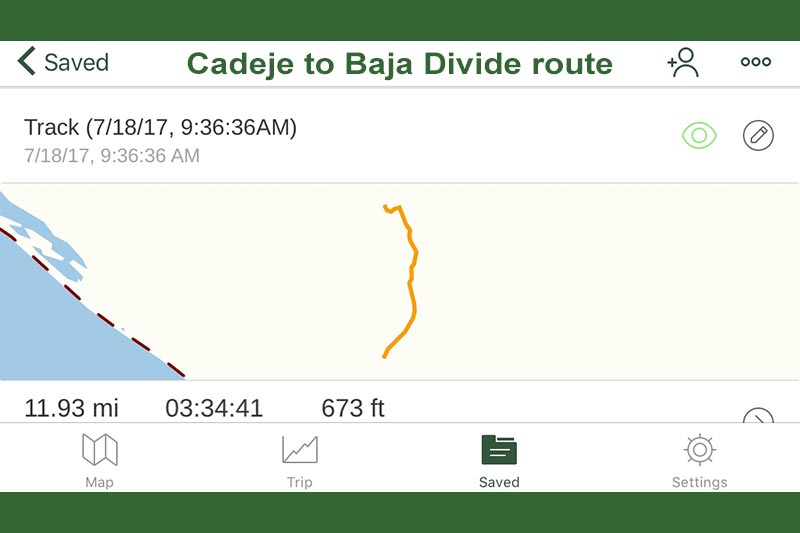
Distance from Cadeje to Baja Divide junction: 11.93 miles.
In case you want to follow our track.
Now back on the Divide route.
Had to bust out the zoom lens for this shot.
Water!
In spite of the tough riding, or perhaps because of it, we really enjoyed the trip. The scenery was epic in the canyon, with sheer rock cliffs bookending us for the duration. With an obvious abundance of water, be it, at this time, mostly below the surface of the ground, there were also shade trees everywhere, solving one of the other problems, a nice spot to rest. Yes, we were climbing the entire day, but the increase in elevation was so subtle that it mostly went unnoticed. That is how climbing should be done!

Our epic camping spot!
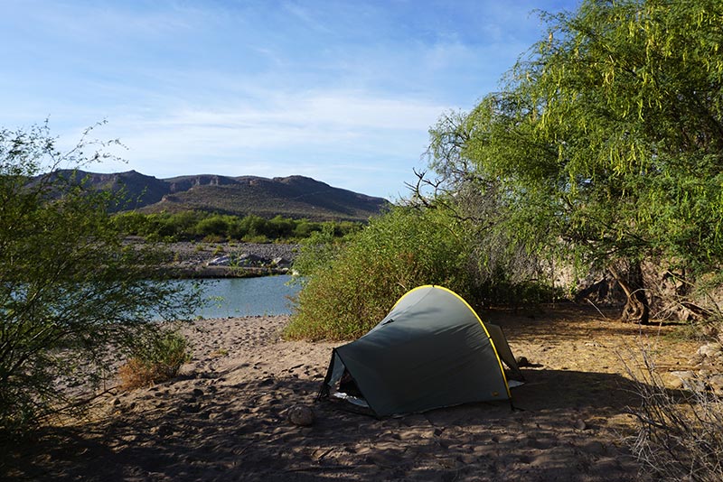
Flat spot for tent.
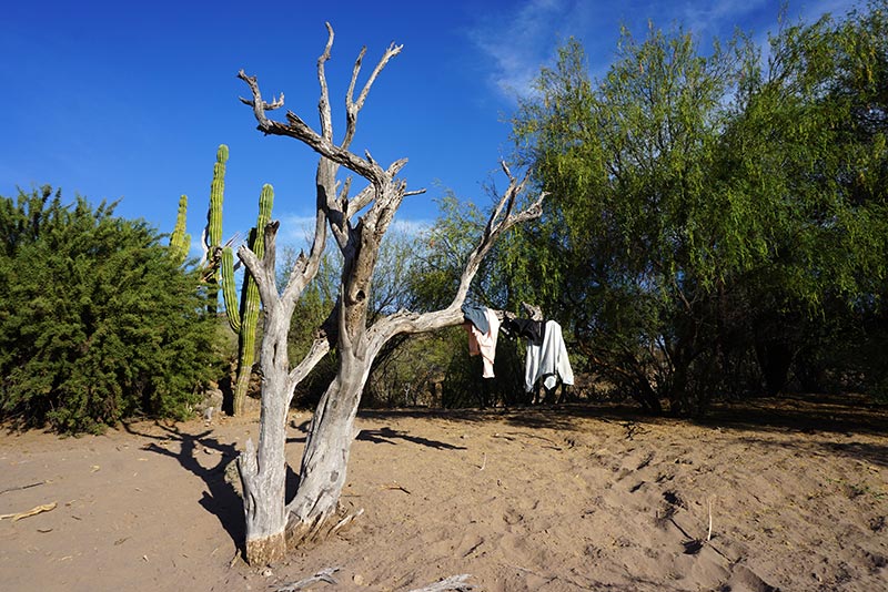
Tree for hanging clothes.
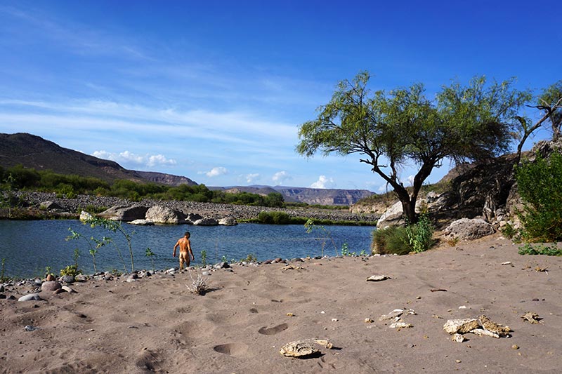
Water for swimming! Sorry for the butt shot. Rebecca had the camera.
We also ticked off a couple of other firsts. Around mid afternoon, just after passing by a mother goat and her kid, we had a bobcat run across the trail in front of us. We must have surprised him as much as he surprised us because he turned around, and ran back in the direction that he came from. Almost immediately after that, we saw the carcass of a goat, and then a cow. Coincidence? I don’t know. You’ll have to ask the bobcat!

Shade!
Rocks to sit on.

Beautiful scenery. The bar has been set high!
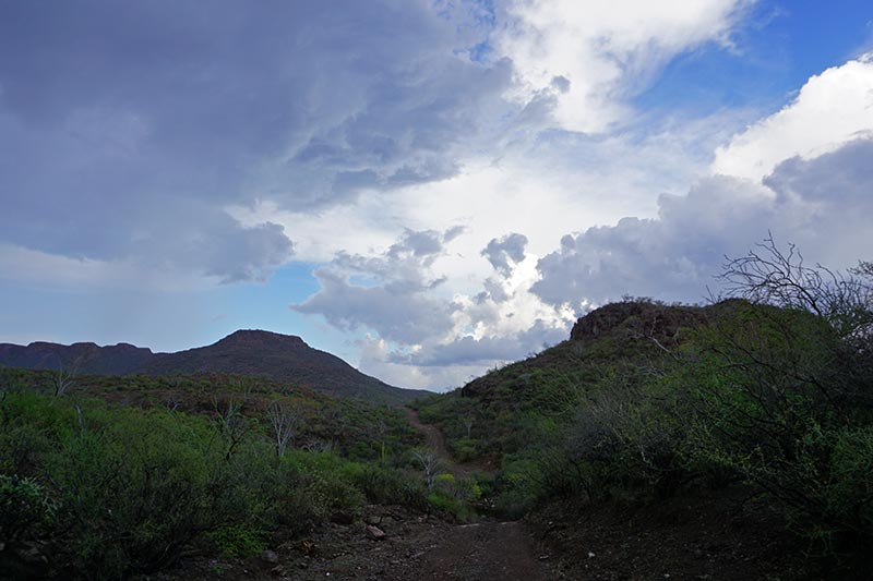
Many may be surprised to hear that we have yet to be caught in a rain storm. That’s one of the benefits of riding in Baja in July, I guess, but yesterday, it happened. It happened so quickly that we just weren’t prepared for it! We were taking a little break under a shade tree when we each noticed a drop or two of water on our arms. Just in case, we tucked our iPhones away in our waterproof bags, but we made no attempt to hide from the rain, or to put on rain jackets. After all, how much could it really rain? Well, the answer to that question is, a lot!

And we win another cow-bike standoff.

The bandana on my head looks like big ears.
Those few intermittent drops of rain soon turned into a deluge, one accompanied by loud thunder, and although we couldn’t see it, presumably lightning. We still had not yet donned our jackets but took one of our sleeping pads off the front of our bikes and stood there, under the tree, with it draped across our heads. It was a pale excuse for shelter. About this time three cars, yes three, in a row, drove by us. This is notable because we hadn’t seen a single vehicle all day, unless you count the cowboy on the horse who rode by us as we were having breakfast. As we stood there with our sleeping pad on our heads, looking ridiculous, all three cars drove by us without stopping. Unusual.

We had scenery like this the entire way.

More evidence of water.
As the storm fully established itself, the temperature dropped considerably. By that point our clothes were fully soaked through, and we started to get chilly. We each put on our raincoats, and that helped, for a time. Creatively, as we sat there getting rained on, Rebecca took note of the water pouring off the edge of the sleeping pad, and started refilling our water bottles from the runoff. Although we still had some water with us, we were running a bit low, and hadn’t yet made any effort to resupply.

Rain? Note no attempt being made to avoid it.

We had to carry the bikes across this “road,” one at a time!
With the bottles full but the storm nowhere near ready to abate, we decided to ride on to see if there was better shelter up ahead. Amusingly, we found a ranch just around the next bend. Salvation! No, no salvation. Not amusingly, there was no one home at the ranch. No one except a couple of big dogs whose bark said, “Don’t you dare open that gate and come in here!“
The storm has abated.
That would suck! Now on the steep descent on the Mulege side of the mountain.
We stood outside the fence line, yelling to anyone who would listen, but it was apparent that no one was home. Perhaps the residents of the ranch had also been caught out in the storm, and were taking shelter elsewhere. With hypothermia not far off, and the clouds seemingly stationary over our heads, we decided to make another break for it, in spite of the fact that the electrical storm was still cracking. In addition to the thunder and lightning, we also had to deal with another result of such a fierce desert storm: the roads were turning into rivers!

More epic scenery.

We were warm again by this point.
Where most roads were dry as a bone earlier in the day, and creek beds may have had only a trickle of water, rivers now ran. We came to several sections that were so fast moving and deep that we had to carry the bikes across, one at a time, and carefully too so that we weren’t knocked over by the strong current. If there is a good point to this, it’s that we were, by then, near the top of the canyon. As we made way as quickly as we could, we both started to heat our bodies up, and outrun the worst of the flooding water. And ultimately, perhaps 30 minutes or so later, the rain abated, and the thunder became less and less frequent.

This morning, before the sun has made its way over all the hills.

The sun winking at us.
There was only one thing on our minds at this point, find a place to camp so that we could get into some dry clothes. The problem was, we were near the top of the climbing, and the roadside was steep, with nowhere to pitch a tent. As we breached the final pass, we started an incredibly steep descent, again, with nowhere to camp. Fortunately, after dropping a few hundred feet, we found a tiny flat area just big enough for our tent. It was a spot obviously popular with goats and cows, but by that point, we’d have been willing to fight them for it.

Here it comes.
I kept driving off the road looking at the scenery.
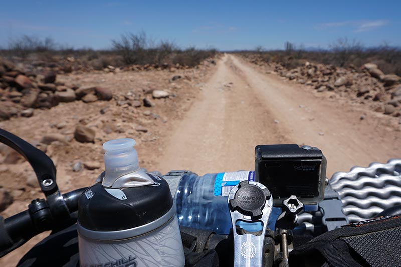
This morning’s ride to Mulege began early, pre-breakfast, as we were running low on water, and thus wanted to get most of the 32km we needed to cover completed before it became too hot. The scenery during the initial descent was so epic that I continually found myself running off the track as I was gawking around so much. The Baja Divide route guide noted that the roads on the Mulege side of the mountain had been better maintained than on the side we’d spent most of the prior two days. Unfortunately, better roads means that people can drive more quickly, which means that they end up getting washboarded. That was the only low point of the trip (the electrical storm was an adventure, not a low point), and probably the only thing that I felt compelled to complain about.
Looking back towards where we came from.
We had a bit of climbing to do this morning. Just a bit.
Mulege, like San Ignacio, is described as an oasis, and it’s obviously true, as we were greeted with an abundance of greenery as we approached it. I suspect that we’ll spend a few days here before pushing on. My guess is that there’s enough to keep us busy here for a while.

Palm trees greet us in Mulege.
Trip Stats:
- San Juanico to Cadeje: 14.6km, 2:57 hours (day 1)
- Cadeje to Baja Divide junction: 19.1km, 3:34 hours (day 1)
- Baja Divide junction to Wild Camping: 10.8km, 2:26 hours (day 1)
- Wild Camping to Wild Camping: 43.6km, 11:11 hours (day 2)
- Wild Camping to Mulege: 33.2km, 3:56 hours (day 3)

Glad you made it through so Easily! I lost count at 25 river crossings. More than 1/2 were Running! Good job!
Well, I wouldn’t say that is was easy. 🙂
Great photos and description of your journey, loving every bit of it !
Thanks, Mike!
Just…Wow!
You’d love it.
You guys sure do get around!
Slowly but surely.
youtube.com/watch?v=guZUYToWdYI&list=RDguZUYToWdYI#t=0
Just a bit of entertainment for you two– You did say “The Road Goes on Forever”..
I was actually thinking of this one when I wrote that:
https://youtu.be/7lTjsU-iJyM
Impressive. Great blogging, too.
Thanks, Amigo.
definitely enjoying your writing and the pictures are wonderful – you really are seeing beautiful countryside – thanks for sharing with those of us not willing to do the work that you two are. As you well know from living on a sailboat, you are very adapt at collecting rainwater – glad it rained so you could replenish, but as you know you do need to be sure not to get too cold from it. We remember when we were hiking in the Kalahari Desert we kept wishing for rain, but when it came, we weren’t so happy with the cold. Again, thanks for sharing
Yes, you sure can get cold quickly when you’re wet, and it’s windy!
It;s sort of the spirit of bicycles that turning around, and trying an unknown way. I know that feeling – it’s real adventure. Happy for you!! Great post. That looks like an awesome campsite for sure.
Thanks, Sal.
I have been enjoying your blogs for some time now. This one is epic! I love your descriptions and pics.
Safe travels
Val
Thanks very much, Val!