A Hiking Trifecta
It’s been a while since we’ve posted a barrage of hiking pics so I thought I’d take advantage of our good Wi-Fi here and share what we were up to yesterday. On Union Island, virtually right in front of where we are anchored, are three peaks which border the town of Ashton: Mt. Taboi, Mt. Parnassus and the Pinnacle. It was a foregone conclusion that we had to climb at least one of them while we were here.
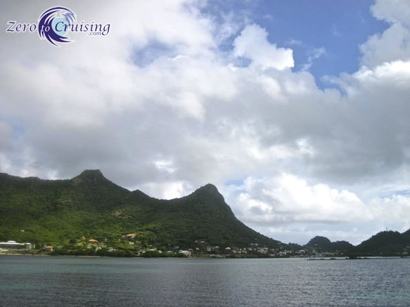
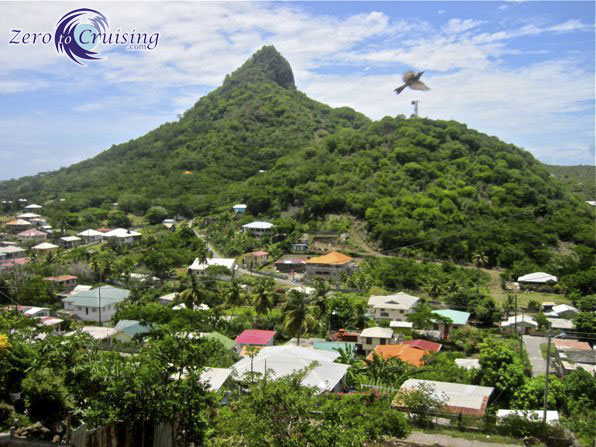
From our boat looking towards the town of Ashton. The two tall peaks in the photo are Mt. Taboi (left) and Mt. Parnassus (center).
We set off with the intention of first climbing the 247m high Mt. Parnassus and if that went well, we’d continue on to the top of Mt. Taboi which stands adjacent to it, 300m high. As it turns out, we got a little mixed up and ended up on top of Mt. Taboi first. The summit offered perhaps the best view we have had of the Caribbean and with such a clear day, we could see all the way from Bequia and the Tobago Cays down to Grenada. After descending from Mt. Taboi, we were able to pick up the trail to Mt. Parnassus and although it didn’t offer such a great view of the islands, the town of Ashton, and the Pinnacle on the other side of it, were both staring us in the face.
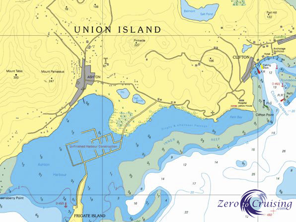
The chart shows where each of the three peaks are located. We are anchored by the little red anchor symbol.
It was only as we made our way down from the second peak that I got the idea of climbing the Pinnacle too and since we were making good time and the day was so nice, we decided to give it a go (note that when I say WE I actually meant I, of COURSE Rebecca was up for this). Not planning on doing this climb though, we didn’t bring any detailed directions with us so Rebecca, the excursion coordinator of the two of us, had to rely on memory. I’m pretty sure we ended up making our own trail for at least a portion of the trek but regardless, we made our way to the top. Although the Pinnacle is the shortest of the three, standing only 227m high, it is the steepest and requires the most technical climbing. Those with a real fear of heights should probably avoid this one! There are a few spots near the top where one step sideways in the wrong direction would seriously ruin your day, and every day to follow. The summit sure does provide a platform for some great pics though!
From the time we left the boat until the time we returned after hiking the three big hills, just under 4.5 hours had elapsed. For those visiting Union Island, we’d recommend any one of these hikes, taking into account my cautions about the Pinnacle. Potential climbers should also be prepared for the nasty brush which guards each of these peaks. Protective clothing and a machete would be a very good idea to bring along.
Pics from the Trifecta

To make it to the first trailhead we had to run the gauntlet past these three vicious guard dogs.

A stairway to… heaven? Oh, and be sure to vote NDP.

We saw several of these guys during our travels including a couple who we caught “in the act!”

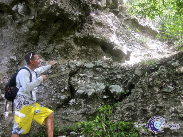
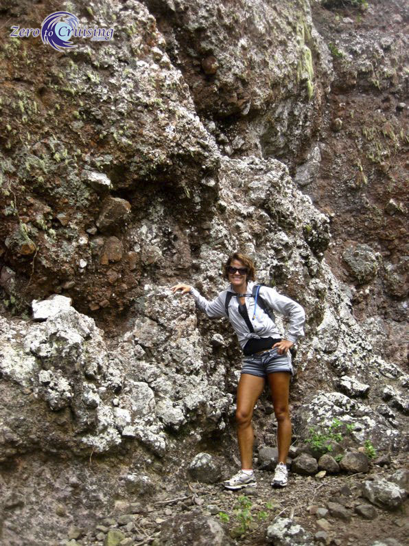
Machete in hand, Mt. Taboi in the distance. Beyond this point there were only goat trails through the thorny brush. The machete was a necessity!

A few of the trail blazers.

On comes the protective shirt.
And up we go.

We’re getting closer.
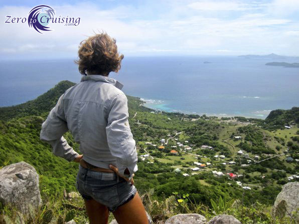
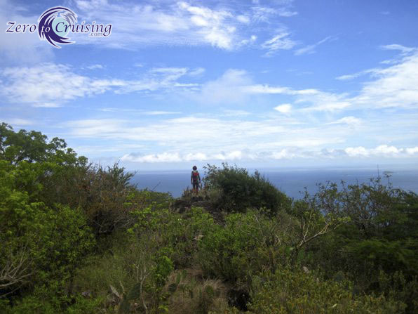
The spectacular view from the summit of Mt. Taboi.

We just have to do at least one of these shots!

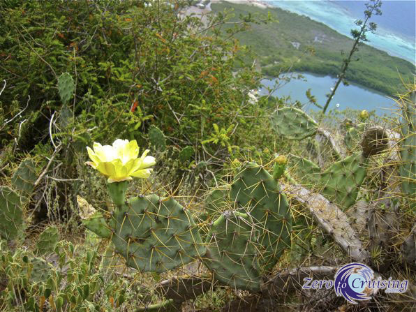
The Guardian of the Summit. Seriously, there are at least 6 different plants here that can, and will, hurt you if you’re not careful. There was a bit of cussing going on as we made our way around, and sometimes through it!

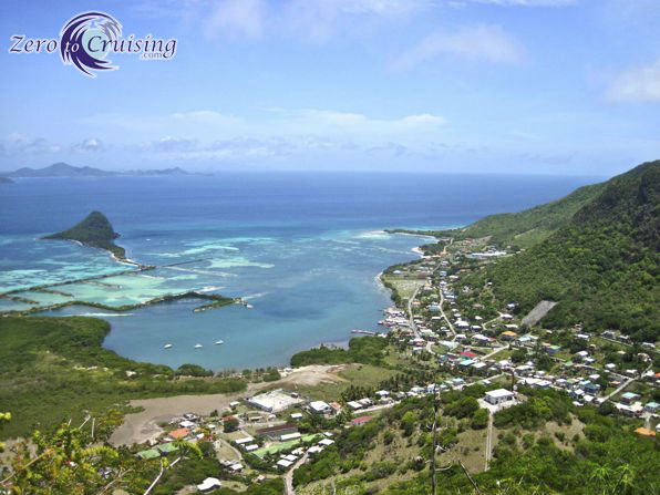
Ashton Harbor with a good view of the uncompleted marina that they started building. Unfortunately the company which began it is no longer in business. In the distance, from right to left, you can see Carriacou, Petite Martinique and Petite St. Vincent.
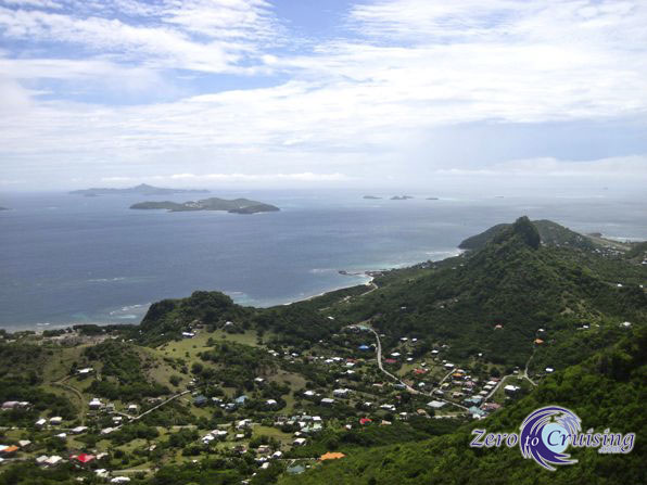
Looking north with Bequia in the far left, Mayreau in the near left and the Tobago Cays on the right.
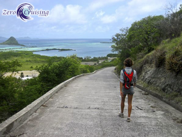
Making our way back down from Mt. Taboi.


Back where we saw the goats, we are about to pick up the trail to Mt. Parnassus.
Yes, that is where we were, Mt. Taboi.
Another one of the “guardians,” this one on top of Mt. Parnassus.
There was also a nice view from Mt. Parnassus but the summit was not so steep or open.
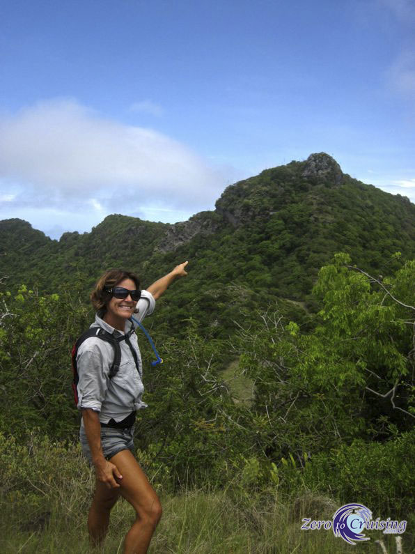
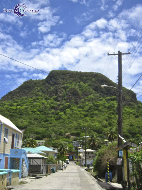
The Pinnacle just begging to be climbed. And where did that bird come from?
Back in the town of Ashton, I quickly snapped this shot of Mt. Parnassus, now behind us.

Our sights were now set on the Pinnacle.
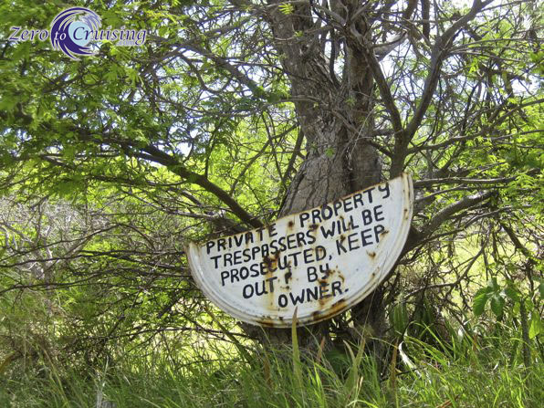
Uh, yeah. I liked the sign but we didn’t go on this particular property.

Somehow we need to get up on top of that! Do you see a trail?

One of the few spots not protected by thorns.
We made it. This shot shows a different perspective of Ashton Harbor, where ZTC is at anchor.
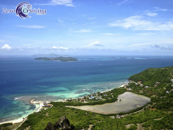
Looking off towards Mayreau and the Cays.

I would like to go on record to say that running to get in the camera frame with only a 10 second timer while perched on top of a rocky hilltop is not all that smart.
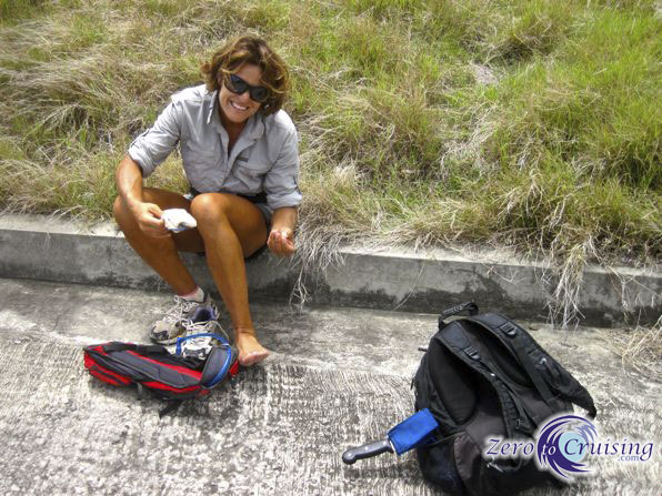
Picking thorns out of our feet. They have a way of making it right through the soft sides of our running shoes and occasionally, right through the hard rubber soles!
Our trifecta now completed, the cold beer is calling!
Great pics as usual! You guys certainly have seen and done a lot in your few years of traveling! Looking forward to your trail guidebook!
Hi Debbie
Thanks. We enjoy doing our “research” for the eBook. 🙂
Great pictures and hike! Do you need permission to access any of these “trails”, or are they public? You two should consider writing a “Hiker’s guide to the Caribbean” or “Conquering the Summits of the Caribbean”, or ???
An eBook is in the works. Some of the trails go across private property and when they do, it’s always best to ask permission.
Lovely pics!
Thanks, Jane.
Really nice pictures – beautiful surroundings.
A couple of questions – what is the weather like? It doesn’t seem sweltering hot because of the clothes you’re wearing. Do the breezes keep it comfortable or are the temps reasonable?
Also what’s that “Unfinished harbor construction” on the charts? There’s a picture that looks like it shows part of it – an overgrown slip-type of configuration.
Hi Jeffrey
When we are near the water, or high on a hilltop, the breezes are very cooling. In the towns, with pavement under our feet, it can be warmer, especially in July and August.
As for the harbor, I don’t know the details. Doyle’s guide book said that a 300 slip marina was planned. What you see in the photo is so large you can’t even really get the perspective of it from ground (or water) level.
Also, we were really only wearing those long shirts to protect ourselves from the thorny bushes. We both would have been wearing much less (shirtless / bikini top) if the terrain permitted it. Fortunately, both of the shirts we were wearing are microfiber so they’re not too hot.
When you look at the picture of you swinging off the boat and the picture above of Ashton Harbor the depth looks like 2 feet although I am sure it is 20 plus feet…..After cruising for sometime now, how important has the shallow draft of the cat been over a shallow draft (5 feet) monohull…….Are you really getting in spots where mono’s cant go or overall it is really overblown…….
Actually the depth in both of those pics was a bit less than 10 feet. We draw 3 feet and Earthling draws 6.5. They anchor pretty much anywhere we do. We COULD go closer but we choose not to. In the Exumas a shallow draft is very nice. Deep draft boats have to be VERY careful in some places there.
Definitely one of your best posts and sets of pictures. It all looks great. Now well beyond me but those thorns are still horribly familiar. Just think, giraffe eat those thorns, and the much bigger ones on acacia, as their staple diet!
Thanks for the chart pic. It gives a good understanding to the rest. But a particular thanks for the views, and explanations, of the surrounding islands. It is difficult from narratives or from Google maps/Earth to get a sense of perspective for the relative distances and sizes involved. That was very helpful, as well as nice.
You look as though you thoroughly enjoyed yourselves!
Mike
You’re very welcome, Mike! We did enjoy ourselves. It was a rewarding morning.
Mike, I think it is one of your best post to date. I wish you would write a (?Book)
or something similiar of your travels including anchoring spots, your opinions of each place you visit and other valuable information for other cruisers. You have a great writing style and present it in a way that is entertaining. Thanks for your post each day. JC
Thanks a lot, JC, I appreciate the feedback and support.
I have a few different projects in mind and they’re on my hurricane season to-do list. 🙂
Hi,
Weird question but the second picture. the map with the heights. where did you get it.. is there a version of it where we can see the whole island in it? I need it of a project of mine.
Thanks
It is a screen capture of a nautical chart. You need all of Union island?